Area Overview for BS14 9RA
Photos of BS14 9RA


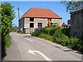
17 photos from this area
Area Information
Key information about the BS14 9RA including its size, population, and administrative classification.
- Area Type
- Postcode
- Area Size
- 9200 m²
- Population
- 1388
- Population Density
- 2234 people/km²
House Prices in BS14 9RA
26
Properties
£186,164
Average Sold Price
£65,500
Lowest Price
£337,290
Highest Price
Showing 26 properties
| Address | Type | Beds | Baths | Last Sale Price | Last Sale Date | |
|---|---|---|---|---|---|---|
| 48 Evercreech Road, Whitchurch, Bristol, BS14 9RA | Semi-detached | 2 | - | £260,000 | Jun 2021 | |
| 42 Evercreech Road, Whitchurch, Bristol, BS14 9RA | Semi-detached | 3 | 2 | £273,000 | Jun 2021 | |
| 36 Evercreech Road, Whitchurch, Bristol, BS14 9RA | Semi-detached | 4 | - | £337,290 | Dec 2018 | |
| 44 Evercreech Road, Whitchurch, Bristol, BS14 9RA | house | - | - | £200,000 | Oct 2018 | |
| 58 Evercreech Road, Whitchurch, Bristol, BS14 9RA | Semi-detached | 3 | 2 | £280,000 | Jul 2016 | |
| 60 Evercreech Road, Whitchurch, Bristol, BS14 9RA | Semi-detached | 3 | - | £260,000 | May 2016 | |
| 70 Evercreech Road, Whitchurch, Bristol, BS14 9RA | house | - | - | £160,000 | Jul 2014 | |
| 62 Evercreech Road, Whitchurch, Bristol, BS14 9RA | house | - | - | £270,000 | Sep 2013 | |
| 52 Evercreech Road, Whitchurch, Bristol, BS14 9RA | Semi-detached | 3 | 1 | £187,000 | Jun 2013 | |
| 78 Evercreech Road, Whitchurch, Bristol, BS14 9RA | Semi-detached | 3 | - | £194,995 | May 2013 |
Page 1 of 3
Energy Efficiency in BS14 9RA
Amenities
Schools
| Rank | School | Type | Entry gender | Ages |
|---|
Explore more schools in this area
Go to Schools tabDemographics
Household Size
Two person
most common
Accommodation Type
Houses
most common
Tenure
87
majority
Ethnic Group
White
most common
Religion
N/A
most common
Household Composition
N/A
most common
Age
47
median
Adults (30-64 years)
most common
Household Deprivation
N/A
with no deprivation
NS-SEC
30
in Lower managerial occupations
Explore more demographic insights in this area
Go to Demographics tabPlanning
Planning Constraints
- Flood RiskPremium
- Ramsar Wetland SitesPremium
- Area of Outstanding Natural BeautyPremium
- Protected Nature ReservePremium
- Protected WoodlandPremium