Area Overview for BS14 9PU
Photos of BS14 9PU

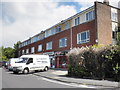
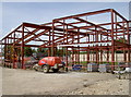
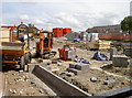
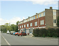
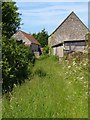
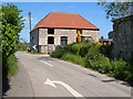
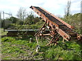
17 photos from this area
Area Information
Key information about the BS14 9PU including its size, population, and administrative classification.
- Area Type
- Postcode
- Area Size
- 1.2 hectares
- Population
- Not available
- Population Density
- Not available
House Prices in BS14 9PU
33
Properties
£230,460
Average Sold Price
£49,500
Lowest Price
£330,000
Highest Price
Showing 33 properties
| Address | Type | Beds | Baths | Last Sale Price | Last Sale Date | |
|---|---|---|---|---|---|---|
| 36 Allerton Crescent, Whitchurch, Bristol, BS14 9PU | Detached | 3 | 2 | £275,000 | Mar 2024 | |
| 26 Allerton Crescent, Whitchurch, Bristol, BS14 9PU | house | - | - | £313,500 | Nov 2023 | |
| 62 Allerton Crescent, Whitchurch, Bristol, BS14 9PU | Bungalow | - | - | £310,000 | Jul 2021 | |
| 42 Allerton Crescent, Whitchurch, Bristol, BS14 9PU | Semi-detached | 5 | 2 | £330,000 | Mar 2021 | |
| 28 Allerton Crescent, Whitchurch, Bristol, BS14 9PU | Semi-detached | 2 | 1 | £200,000 | Feb 2021 | |
| 30 Allerton Crescent, Whitchurch, Bristol, BS14 9PU | Bungalow | 2 | 1 | £300,000 | Feb 2021 | |
| 64 Allerton Crescent, Whitchurch, Bristol, BS14 9PU | Semi-detached | 3 | 1 | £257,000 | Feb 2020 | |
| 60 Allerton Crescent, Whitchurch, Bristol, BS14 9PU | Semi-detached | 3 | - | £290,000 | Sep 2018 | |
| 14 Allerton Crescent, Whitchurch, Bristol, BS14 9PU | Bungalow | 2 | - | £274,000 | May 2018 | |
| 48 Allerton Crescent, Whitchurch, Bristol, BS14 9PU | Semi-detached | - | - | £250,000 | Apr 2018 |
Page 1 of 4
Energy Efficiency in BS14 9PU
Amenities
Schools
| Rank | School | Type | Entry gender | Ages |
|---|
Explore more schools in this area
Go to Schools tabDemographics
Household Size
Two person
most common
Accommodation Type
Houses
most common
Tenure
77
majority
Ethnic Group
White
most common
Religion
N/A
most common
Household Composition
N/A
most common
Age
47
median
Adults (30-64 years)
most common
Household Deprivation
N/A
with no deprivation
NS-SEC
26
in Lower managerial occupations
Explore more demographic insights in this area
Go to Demographics tabPlanning
Planning Constraints
- Flood RiskPremium
- Ramsar Wetland SitesPremium
- Area of Outstanding Natural BeautyPremium
- Protected Nature ReservePremium
- Protected WoodlandPremium