Area Overview for BS13 9JZ
Photos of BS13 9JZ
Area Information
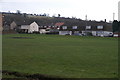
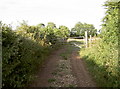
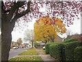
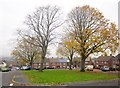
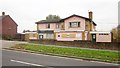
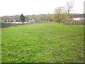
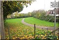
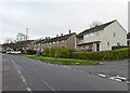
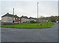
Living in BS13 9JZ means calling Hartcliffe home, a post-World War II suburb situated on the southern edge of Bristol at the foot of Dundry Hill. This residential cluster, defined by postcode BS13 9JZ, sits adjacent to Withywood on the northern slopes of the hill. Construction began in 1952 after Bristol City Council compulsorily purchased farms to meet the city's need for new homes. The estate originally planned for 3,100 homes included schools, churches, and a cinema, though budget cuts meant some facilities never materialised. Today, the area consists largely of council houses built from reinforced concrete, featuring semi-detached properties and large gardens that distinguish it from inner-city terraced housing. The community has a rich history, including the opening of St Andrew Church in 1956 and the notable 1981 riots which led to the construction of the Gatehouse Centre. While the original vision for a complete neighbourhood unit was scaled back, the area retains a strong identity. You will find yourself in a suburb that has evolved from an ambitious project into a established outer suburb. The current layout reflects decades of modification, with the Imperial Retail Park now occupying part of the former Imperial Tobacco factory site. For those looking for a specific postcode covering a small residential cluster, BS13 9JZ offers a distinct slice of Bristol's suburban history.
- Area Type
- Postcode
- Area Size
- Not available
- Population
- 1628
- Population Density
- 5238 people/km²
The property market in BS13 9JZ is characterised by a predominance of houses, reflecting the post-war development style of Hartcliffe. Owning a home here offers a specific entry point into the market, as 49% of residents are homeowners. This indicates a balanced market where neither buying nor renting completely dominates the landscape. The housing stock largely consists of semi-detached properties and detached homes set back from the road with large gardens. This differs significantly from the terraced housing found in Bristol's city centre. For buyers scanning the small residential cluster of BS13 9JZ, the presence of council houses provides a range of options regarding size and property age. The accommodation types seen here are traditional family homes rather than modern apartments or high-density flats. When considering homes in BS13 9JZ, you will find properties that align with family living needs more than urban investment strategies. The 49% ownership rate suggests a community invested in local property values. If you prefer a single-family home with rear access and garden space, this area presents a viable option that prioritises established housing stock over new builds.
House Prices in BS13 9JZ
No properties found in this postcode.
Energy Efficiency in BS13 9JZ
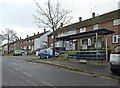
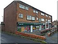
Residents of BS13 9JZ enjoy a wide array of nearby amenities within easy reach. Five retail locations are available, including Morrisons Daily, Morrisons Hartcliffe, and Iceland Symes. These shops are located in places like Symes Avenue, which was among the first developments in the area. You can fulfil most daily shopping needs without a long journey. For leisure and transport, five rail stations such as Bedminster and Bristol Temple Meads are close by, alongside five ferry landings at locations like Nova Scotia and Pumphouse Ferry Landing. A single metro stop in Bitton provides additional travel connectivity. Two airports, both Bristol Airport, are near the postcode, facilitating travel across the country. The Gatehouse Centre serves as a community hub with business workshops and employment training facilities, a direct result of the 1981 riot redevelopment. St Andrew Church, opened in 1956, adds a historic and spiritual focus to the suburb. The Imperial Retail Park features the converted headquarters building known as Lakeshore flats. This mix of shops, transport hubs, and community buildings ensures that living in BS13 9JZ involves access to essential services and cultural landmarks right on your doorstep.
Amenities
Schools
Families considering schools near BS13 9JZ will find Fair Furlong Primary School in the immediate vicinity. This institution holds a 'good' Ofsted rating, providing a standard of education you can verify before moving. The area primarily relies on this primary option, given the limited data on secondary provisions in the immediate cluster. The presence of a primary school with positive regulatory standing is a key factor for anyone settling in the Hartcliffe area. The specific listing for Fair Furlong indicates that local education does not require long commutes for younger children. You do not need to drive far to ensure your children attend a school with a government-approved quality rating. If your children require primary education, you have access to a facility that has passed strict inspection criteria. The concentration of a single primary school suggests a community-focused educational environment where neighbours often share the same local institution. This setup supports the area's identity as a residential estate built around family life, with schooling integrated into the neighbourhood fabric.
| Rank | School | Type | Entry gender | Ages |
|---|
Explore more schools in this area
Go to Schools tabDemographics
The community within BS13 9JZ is defined by a population of 1,628 people with a median age of 47 years. Adults aged between 30 and 64 years are the most common demographic group. Home ownership stands at 49%, meaning nearly half of the residents own their properties outright or with a mortgage. The remaining households are predominantly rented accommodation. Houses form the primary accommodation type across this postcode area. Ethnically, the predominant group is White. The age profile suggests a mix of established residents and families, typical of a suburb that has been home to people since the 1950s. The nearly equal split between ownership and renting indicates an area where both owner-occupiers and tenants live side by side. The high proportion of adults over 30 in the 47 gives you a consistent age range. This demographic balance means the area functions as a stable residential zone without the volatility of purely student districts or transient tenancies. You are looking at a settled community where adults dominate the housing stock and economic activity.
Household Size
Accommodation Type
Tenure
Ethnic Group
Religion
Household Composition
Age
Household Deprivation
NS-SEC
Explore more demographic insights in this area
Go to Demographics tabPlanning
Planning Constraints
- Flood RiskPremium
- Ramsar Wetland SitesPremium
- Area of Outstanding Natural BeautyPremium
- Protected Nature ReservePremium
- Protected WoodlandPremium