Area Overview for BS13 9EL
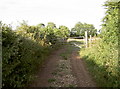
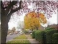
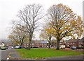
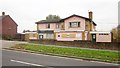
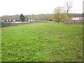
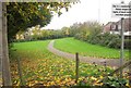
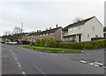
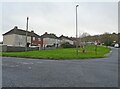
Photos of BS13 9EL
Area Information
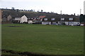
BS13 9EL, part of Hartcliffe in Bristol, is a small residential cluster with a population of 1392, situated on the city’s southern edge at the foot of Dundry Hill. Developed in the 1950s as a post-war housing estate, it sits alongside Withywood and forms a single electoral ward. The area’s semi-detached homes and large gardens distinguish it from inner-city terraces, though early residents faced unmet promises of community facilities like libraries and swimming pools. Today, it blends practical living with historical legacy, adjacent to the Imperial Retail Park and the Gatehouse Centre, a hub for local services. With rail links to Bristol Temple Meads and ferry access to nearby waterways, it balances suburban tranquillity with urban connectivity. The median age of 47 suggests a community of working-age adults, many of whom live in owner-occupied or rented properties. While the area’s history includes social challenges, its proximity to transport networks and amenities like Morrisons Daily makes it a practical choice for those seeking affordability and accessibility in Bristol’s outer reaches.
- Area Type
- Postcode
- Area Size
- Not available
- Population
- 1392
- Population Density
- 3546 people/km²
The property market in BS13 9EL is characterised by semi-detached houses, with 48% of residents owning their homes. This indicates a modest owner-occupied market, but with a strong rental component due to the remaining 52% of properties likely being let. The housing stock, developed in the 1950s, features large gardens and traditional post-war design, which may appeal to buyers seeking space and affordability. However, the small area size means the market is limited, with limited scope for new developments. The presence of the Imperial Retail Park and Gatehouse Centre suggests proximity to employment opportunities, though the area’s history of underfunded amenities may affect property desirability. For buyers, the semi-detached layout and garden space offer practical advantages, but the rental market’s dominance could influence price trends. Given the area’s proximity to transport hubs like Bristol Temple Meads, it may attract commuters seeking value-for-money homes in a functional suburban setting.
House Prices in BS13 9EL
No properties found in this postcode.
Energy Efficiency in BS13 9EL
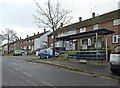
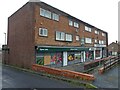
Living in BS13 9EL offers access to a range of amenities within practical reach. The area’s retail options include Morrisons Daily at several locations, providing essential shopping for residents. Nearby rail stations like Parson Street and Bedminster connect to Bristol Temple Meads, while ferry landings such as Cottage Ferry and Pumphouse Ferry offer water-based transport links. The Imperial Retail Park, occupying part of the former Imperial Tobacco site, hosts businesses and services, and the Gatehouse Centre provides community spaces, employment training, and a café. St Andrew Church, opened in 1956, adds to the area’s historical character. Symes Avenue features a small shopping area, and the Bitton metro station offers further connectivity. While the area lacks high-end dining or entertainment, its practical amenities and transport links make it suitable for those prioritising convenience over luxury. The semi-detached homes with gardens complement a lifestyle focused on affordability and accessibility, though the absence of newer leisure facilities may require residents to travel for more specialised services.
Amenities
Schools
| Rank | School | Type | Entry gender | Ages |
|---|
Explore more schools in this area
Go to Schools tabDemographics
The population of BS13 9EL has a median age of 47, with the most common age range being adults aged 30–64. This suggests a community centred around working-age individuals, many of whom may be employed in nearby sectors such as retail or logistics. Home ownership in the area stands at 48%, meaning nearly half of residents rent their homes, reflecting a mix of owner-occupied and rental properties. The predominant accommodation type is houses, typically semi-detached, which aligns with the area’s post-war development model. The White ethnic group constitutes the majority, though no specific data on other demographics is provided. The absence of detailed diversity metrics means the area’s social composition remains partially unexplored. With 48% ownership, the rental market is significant, potentially influencing property values and investment opportunities. The age profile and housing stock suggest a stable, family-oriented environment, though the area’s historical challenges, such as underfunded infrastructure, may affect long-term quality of life.
Household Size
Accommodation Type
Tenure
Ethnic Group
Religion
Household Composition
Age
Household Deprivation
NS-SEC
Explore more demographic insights in this area
Go to Demographics tabPlanning
Planning Constraints
- Flood RiskPremium
- Ramsar Wetland SitesPremium
- Area of Outstanding Natural BeautyPremium
- Protected Nature ReservePremium
- Protected WoodlandPremium