Area Overview for BS13 8PT
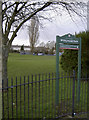
Photos of BS13 8PT


Area Information
Living in BS13 8PT means residing within Hartcliffe, an outer suburb of Bristol situated on the southern edge of the city at the foot of Dundry Hill. This specific postcode area covers a small residential cluster of just one hectare, yet it holds a population of 1,478 people. The neighbourhood is defined by its post-World War II origins, having been developed largely as a council housing estate after 1952. During its planning phase, the vision was for a self-contained neighbourhood unit with extensive community facilities, though budget constraints meant many promised amenities, such as a cinema and swimming pool, were never realised. The area sits adjacent to Withywood, forming a combined electoral ward with it. You will find yourself in a community where the original ambition to recreate a comprehensive village life gave way to practical, semi-detached housing with large gardens. This history shapes the district's distinct character, separating it physically from the terraced inner-city homes of Bristol. While the development began with grand plans, the resulting estate offers a physical layout distinct from the city centre, providing a residential environment that evolved through decades of adjustment and community building.
- Area Type
- Postcode
- Area Size
- 1.0 hectares
- Population
- 1478
- Population Density
- 5945 people/km²
The property market in BS13 8PT is characterised by a housing stock consisting almost entirely of houses. With home ownership standing at 34 per cent, the market presents a mix of owner-occupied and rental properties. You are looking at an area where the physical layout aligns with a post-war council estate model, offering semi-detached homes rather than the terraced housing typical of Bristol's inner city. This specific postcode cluster covers one hectare, focusing residential activity tightly around the existing infrastructure. Because the original development was scaled back during the 1950s, the available homes reflect the practical constraints and policy shifts of that era, resulting in larger gardens than found in urban terraced streets. Buyers considering homes in this area should note that the 34 per cent ownership rate means a substantial portion of listings may be available through the private rental sector. The market is not driven by high-end luxury developments but by the established residential units that define the Hartcliffe estate. Understanding the balance between rental inventory and owner-occupied stock is essential when navigating property options in this specific location.
House Prices in BS13 8PT
Showing 28 properties
| Address | Type | Beds | Baths | Last Sale Price | Last Sale Date | |
|---|---|---|---|---|---|---|
| 60 Keble Avenue, Bishopsworth, Bristol, BS13 8PT | Terraced | 4 | 1 | £310,000 | Jul 2025 | |
| 68 Keble Avenue, Bishopsworth, Bristol, BS13 8PT | house | 4 | - | £295,000 | May 2022 | |
| 74 Keble Avenue, Bishopsworth, Bristol, BS13 8PT | Terraced | 3 | 1 | £192,500 | Nov 2019 | |
| 70 Keble Avenue, Bishopsworth, Bristol, BS13 8PT | Terraced | 4 | 1 | £224,995 | Jul 2019 | |
| 58 Keble Avenue, Bishopsworth, Bristol, BS13 8PT | Terraced | 3 | - | £187,000 | Jan 2019 | |
| 54 Keble Avenue, Bishopsworth, Bristol, BS13 8PT | Terraced | 4 | 2 | £220,000 | Apr 2017 | |
| 72 Keble Avenue, Bishopsworth, Bristol, BS13 8PT | house | - | - | £81,500 | Sep 2003 | |
| 64 Keble Avenue, Bishopsworth, Bristol, BS13 8PT | Terraced | 3 | 1 | - | - | |
| 59 Keble Avenue, Bishopsworth, Bristol, BS13 8PT | Flat | - | - | - | - | |
| 62 Keble Avenue, Bishopsworth, Bristol, BS13 8PT | house | - | - | - | - |
Energy Efficiency in BS13 8PT
Daily life in BS13 8PT benefits from a practical range of amenities located within practical reach of the residential cluster. You have access to five retail options, including Morrisons Daily Bristol, Morrisons Daily, and Morrisons Daily, ensuring convenience stores are close by. For travel, five rail stations serve the area, with Parson Street Railway Station, Bedminster Railway Station, and Bristol Temple Meads Railway Station offering connections to wider Bristol and the national network. Ferry services are also available via Cottage Ferry Landing, Nova Scotia Ferry Landing, and Pumphouse Ferry Landing for those needing water transport. Bristol Airport and Bristol Airport provide two locations for travel, placing the region within reach of international destinations. The Gatehouse Centre sits nearby, incorporating business workshops, employment training, a crèche, and café facilities that serve the community. St Andrew Church, opened in 1956, anchors the local history and provides a focal point for social gathering and religious life. This combination of retail, rail, ferry, and airport access, alongside community centres, creates a functional lifestyle where essential services and leisure activities are readily accessible without long commutes.
Amenities
Schools
Families considering schools near BS13 8PT have access to three established educational institutions within close proximity. You can easily reach Four Acres Primary School, which serves the local community with a primary education focus. For special educational needs, Belgrave School offers support with a ofsted rating of good. Further education options include Four Acres Academy, an academy with a ofsted rating of good also. This mix of primary, academy, and special needs provision suggests the area caters to a range of educational requirements. The presence of two institutions rated good by Ofsted provides assurance regarding the quality of education available to children living in the neighbourhood. Residents do not need to travel far to access formal education, as these schools are located in the immediate vicinity of the housing estate. The availability of a special school alongside standard primary and academy options indicates an inclusive educational environment that addresses diverse learning needs for students residing in BS13 8PT.
| Rank | School | Type | Entry gender | Ages |
|---|
Explore more schools in this area
Go to Schools tabDemographics
The community in BS13 8PT reflects a mature demographic profile with a median age of 47 years. The majority of residents fall into the adult age range of 30 to 64 years. You will find that household structures tend towards stability, supported by accorommodation that is predominantly houses. Home ownership stands at 34 per cent, indicating a significant proportion of the population remains within the rented sector. The area is also demographically established, with the White ethnic group being the predominant demographic. With a population density of 141,087 people per square kilometre, the housing is concentrated within this small one-hectare footprint. This density, combined with the age profile, suggests an area where long-term residents have established deep roots. The age distribution implies a neighbourhood without a strong young career starter cohort but rather one populated by established families and mature adults. The social fabric is shaped by this stability, where the historical context of the estate's development continues to influence the daily interactions of the residents who call this specific postcode their home.
Household Size
Accommodation Type
Tenure
Ethnic Group
Religion
Household Composition
Age
Household Deprivation
NS-SEC
Explore more demographic insights in this area
Go to Demographics tabPlanning
Planning Constraints
- Flood RiskPremium
- Ramsar Wetland SitesPremium
- Area of Outstanding Natural BeautyPremium
- Protected Nature ReservePremium
- Protected WoodlandPremium