Area Overview for BS13 8PH
Photos of BS13 8PH


Area Information
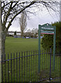
Living in BS13, known locally as Hartcliffe, offers a distinct post-war suburb experience on the southern edge of Bristol. This specific postcode cluster covers a small residential ground area of 1809 square metres that houses 1,546 people. The location sits at the foot of Dundry Hill, forming a combined electoral ward with the neighbouring estate of Withywood. Construction began in 1952 after Bristol City Council compulsorily purchased local farms to meet a city-wide need for thirty thousand new homes. While original plans promised cinemas and swimming pools, government funding changes meant the estate opened as a neighbourhood unit with semi-detached houses and large gardens instead. You are stepping into a community with a defined identity, shaped by its history of industrial employment at the former Imperial Tobacco factory and subsequent economic shifts. The area remains a residential cluster where daily life revolves around its self-contained character. It is an established environment where the legacy of post-war planning discussions from 1943 creates a unique physical footprint. Prospective residents find themselves in a neighbourhood that has evolved from its initial development phase into a stable living space.
- Area Type
- Postcode
- Area Size
- 1809 m²
- Population
- 1546
- Population Density
- 4809 people/km²
The housing market in BS13 8PH is characterised by a dominance of freehold or leasehold homes rather than multi-unit blocks. Data confirms that houses constitute the primary accommodation type for this residential cluster. You will find a significant number of semi-detached properties with large gardens, a physical distinction from the terraced housing found in inner-city neighbourhoods. With 59 per cent of homes owned, this area operates more as an owner-occupied market than a high-volume rental block. The limited land area of 1809 square metres means these properties are often densely packed within a specific cluster, typical of post-war council estates expanded after 1949. Buyers here should expect a stock that largely consists of the original construction phases, with only later conversions like the Lakeshore flats appearing within the vicinity. This housing stock offers established layouts rather than modern renovations as the primary selling point. The market reflects a shift from the initial ambition of building thirty thousand homes to the reality of smaller, cheaper pre-reinforced concrete builds due to budget constraints in the late 1940s.
House Prices in BS13 8PH
Showing 15 properties
| Address | Type | Beds | Baths | Last Sale Price | Last Sale Date | |
|---|---|---|---|---|---|---|
| 80A Queens Road, Bishopsworth, Bristol, BS13 8PH | Maisonette | - | - | £135,000 | Jun 2015 | |
| 94A Queens Road, Bishopsworth, Bristol, BS13 8PH | Flat | - | - | £82,000 | Sep 2014 | |
| 82A Queens Road, Bishopsworth, Bristol, BS13 8PH | Flat | - | - | - | - | |
| 88A Queens Road, Bishopsworth, Bristol, BS13 8PH | Maisonette | - | - | - | - | |
| 98A Queens Road, Bishopsworth, Bristol, BS13 8PH | Flat | - | - | - | - | |
| 78A Queens Road, Bishopsworth, Bristol, BS13 8PH | Flat | - | - | - | - | |
| 90A Queens Road, Bishopsworth, Bristol, BS13 8PH | Maisonette | - | - | - | - | |
| 92A Queens Road, Bishopsworth, Bristol, BS13 8PH | Maisonette | - | - | - | - | |
| 102A Queens Road, Bishopsworth, Bristol, BS13 8PH | Flat | - | - | - | - | |
| 86A Queens Road, Bishopsworth, Bristol, BS13 8PH | Flat | - | - | - | - |
Energy Efficiency in BS13 8PH
Daily life in BS13 8PH benefits from a wide range of transport and retail options situated within practical reach. You have access to five distinct railway stations, including Parson Street, Bedminster, and Bristol Temple Meads, alongside five ferry landings such as Nova Scotia and Pumphouse Ferry Landing. Two major airports, Bristol Airport, serve the region for travel needs. Retail needs are met by five Morrisons Daily outlets located nearby. For leisure and community activities, the Gatehouse Centre offers business workshops, a café, and community spaces. The Imperial Retail Park occupies the former Imperial Tobacco factory site, providing further shopping and employment facilities. St Andrew Church, which opened in 1956, remains a focal point for community activities. A small shopping area exists on Symes Avenue. Residents can walk to these venues, which were developed to address local needs following the 1981 riots and industrial decline. The presence of these specific landmarks means you do not rely solely on the city centre for daily necessities.
Amenities
Schools
| Rank | School | Type | Entry gender | Ages |
|---|
Explore more schools in this area
Go to Schools tabDemographics
The community within this postcode area is defined by a mature population profile. The median age stands at 47 years, with adults aged between 30 and 64 years forming the most common age group. This demographic structure suggests a neighbourhood settled by families and established residents rather than transient populations. Home ownership is strong here, with 59 per cent of households owning their property outright or with a mortgage. This ownership rate indicates a stable resident base compared to rental-dominated districts. The prevailing accommodation type consists entirely of houses, reflecting the semi-detached style developed during the 1950s construction boom. The predominant ethnic group is White, aligning with the traditional demographic makeup of many southern Bristol suburbs during the mid-twentieth century. Living in this area means joining a community where household composition tends towards stability and long-term residence. The age profile suggests schools and youth facilities serve a young audience, while the higher proportion of adults over 40 indicates a need for services catering to the middle-aged workforce and retirees.
Household Size
Accommodation Type
Tenure
Ethnic Group
Religion
Household Composition
Age
Household Deprivation
NS-SEC
Explore more demographic insights in this area
Go to Demographics tabPlanning
Planning Constraints
- Flood RiskPremium
- Ramsar Wetland SitesPremium
- Area of Outstanding Natural BeautyPremium
- Protected Nature ReservePremium
- Protected WoodlandPremium