Area Overview for BS12 6SQ
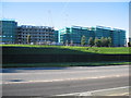
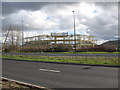
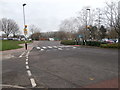
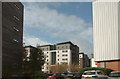
Photos of BS12 6SQ


Area Information
Living in BS12 6SQ means inhabiting a small, densely populated residential cluster in Stoke Gifford, Gloucestershire. With 1,321 residents spread over a compact area, the postcode reflects a community shaped by its rural origins and modern infrastructure. Historically a Norman manor, the area evolved with the arrival of the Great Western Railway in 1903, which transformed it into a hub with accessible transport links to Bristol and beyond. Today, the population density of 712 people per square kilometre suggests a tight-knit neighbourhood, where daily life balances suburban tranquillity with proximity to urban amenities. The area’s demographics—primarily adults aged 30–64—hint at a mature, stable community, with a strong emphasis on homeownership. Residents benefit from nearby schools, rail networks, and retail options, while the low flood risk and proximity to motorways underscore its practical appeal. For those seeking a blend of historical character and modern convenience, BS12 6SQ offers a distinct slice of South West England.
- Area Type
- Postcode
- Area Size
- Not available
- Population
- 1321
- Population Density
- 712 people/km²
The property market in BS12 6SQ is characterised by a 51% home ownership rate, with houses forming the predominant accommodation type. This suggests a community where family homes and long-term residency are common, though the exact proportion of rental properties remains unspecified. As a small postcode area, the housing stock is likely limited, with properties concentrated around the residential cluster. The lack of flats or apartments implies a focus on traditional housing, which may appeal to buyers seeking spacious, private living. Given the area’s proximity to Bristol and its transport networks, properties here may cater to commuters or those prioritising ease of access to urban centres. However, the limited data on property prices or availability means potential buyers should investigate local listings for current market trends.
House Prices in BS12 6SQ
No properties found in this postcode.
Energy Efficiency in BS12 6SQ
The lifestyle in BS12 6SQ is shaped by its proximity to a range of amenities. Within practical reach are five retail outlets, including Lidl Filton, Aldi Fox Den Road, and Sainsburys East, ensuring daily shopping needs are met. The area’s rail network, with five stations including Bristol Parkway, connects residents to broader transport systems, while the Bristol Filton Airport offers regional travel options. Five ferry terminals, such as Netham Lock and Castle Park, provide water-based access to nearby areas. The presence of the Oldland metro station and multiple rail links enhances mobility. These amenities collectively support a convenient, active lifestyle, blending suburban comfort with urban accessibility. The mix of retail, transport, and leisure options makes daily life in BS12 6SQ both practical and varied.
Amenities
Schools
Residents of BS12 6SQ have access to two key educational institutions. Abbeywood Community School serves as both a primary and academy school, with an Ofsted rating of ‘good’. This dual role provides continuity for families needing both early-years and secondary education. Nearby, Bristol Technology and Engineering Academy offers secondary schooling, though its Ofsted rating is not specified in the data. The presence of a rated academy alongside a primary school suggests a well-rounded educational landscape, though the absence of detailed performance metrics for the secondary school leaves room for further inquiry. For families prioritising quality education, the combination of a ‘good’-rated primary and a specialist secondary institution may be a decisive factor in choosing this area.
| Rank | School | Type | Entry gender | Ages |
|---|
Explore more schools in this area
Go to Schools tabDemographics
BS12 6SQ’s population skews towards adults aged 30–64, with a median age of 47. This suggests a community of established professionals and families, likely drawn by the area’s stable housing and transport links. Homeownership stands at 51%, indicating a mix of owner-occupied properties and rentals, though the predominant accommodation type is houses rather than flats. The majority of residents identify as White, reflecting the broader demographic patterns of the region. While no specific deprivation data is provided, the age profile and ownership rates imply a relatively settled population with long-term ties to the area. The absence of detailed diversity metrics means the community’s cultural composition remains less defined, but the presence of multiple schools and amenities suggests a functional, service-oriented local economy.
Household Size
Accommodation Type
Tenure
Ethnic Group
Religion
Household Composition
Age
Household Deprivation
NS-SEC
Explore more demographic insights in this area
Go to Demographics tabPlanning
Planning Constraints
- Flood RiskPremium
- Ramsar Wetland SitesPremium
- Area of Outstanding Natural BeautyPremium
- Protected Nature ReservePremium
- Protected WoodlandPremium