Area Overview for BS11 9ZH
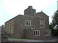
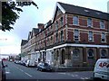
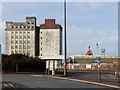
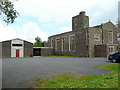
Photos of BS11 9ZH


Area Information
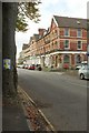
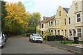
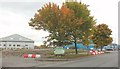
BS11 9ZH is a small residential cluster in Bristol’s northwestern fringe, nestled near Avonmouth docks and the Severn flood plain. With a population of 1,947 and a density of 433 people per square kilometre, it is a tightly packed community shaped by post-war development. The area borders the Blaise Castle Estate to the east and the historic Kings Weston House to the south, blending industrial heritage with green spaces. Originally a rural hamlet, Lawrence Weston expanded in the 1940s and 1950s as a council housing estate, retaining a pragmatic, no-nonsense character. Despite challenges like deprivation and past informal economies, residents have driven community-led regeneration, including the Lawrence Weston Community Hub and a new primary school. Proximity to Avonmouth’s port and industrial zones offers connectivity to major roads like the M5, though the area’s identity is defined by its compact, close-knit nature and a mix of historic buildings amid newer housing. Living here means navigating a balance between industrial proximity and efforts to foster local amenities and social cohesion.
- Area Type
- Postcode
- Area Size
- Not available
- Population
- 1947
- Population Density
- 433 people/km²
The property market in BS11 9ZH is characterised by a 51% home ownership rate, with houses forming the predominant accommodation type. This suggests a mix of owner-occupied homes and rental properties, though the small area’s limited size means housing options are constrained. The presence of post-war council housing indicates a stock of older properties, some of which may require renovation. Buyers should consider that the area’s compact nature and proximity to industrial zones may influence property values, with potential for regeneration through community-led projects like the Lawrence Weston Community Hub. For those seeking owner-occupied homes, the market may offer a range of houses, though availability could be limited. Rental demand may be driven by the area’s affordability compared to central Bristol, though the 51% ownership rate highlights that nearly half of residents are tenants. Prospective buyers should weigh the balance between historical housing stock and ongoing local development efforts.
House Prices in BS11 9ZH
No properties found in this postcode.
Energy Efficiency in BS11 9ZH
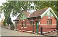
Residents of BS11 9ZH have access to a range of amenities within practical reach, including retail options like Costco Bristol, Co-op Avonmouth, and Morrisons Select, which cater to daily needs. The area’s transport links to Avonmouth’s port and nearby ferry services, such as the Pumphouse Ferry Landing, provide easy access to water-based travel. Nearby, the restored Georgian Kings Weston House and Blaise Castle Estate offer green spaces for leisure, while the Lawrence Weston Community Hub and a new primary school highlight community-focused facilities. The proximity to historic buildings and the Severn flood plain adds a unique character to daily life. Though the area has faced closures in pubs and libraries, local initiatives have improved access to youth facilities and social spaces. The combination of practical amenities, transport options, and community projects creates a lifestyle that balances affordability with efforts to enhance local quality of life.
Amenities
Schools
| Rank | School | Type | Entry gender | Ages |
|---|
Explore more schools in this area
Go to Schools tabDemographics
BS11 9ZH has a median age of 47, with the majority of residents aged 30–64, reflecting a mature population. Home ownership stands at 51%, indicating a mix of owner-occupied properties and rental units. The area is predominantly composed of houses, with the White ethnic group forming the largest demographic. This profile suggests a community of long-term residents and families, though the ward also has a higher-than-average proportion of young people. The 51% ownership rate implies that nearly half of households are renters, which may influence local housing dynamics. Deprivation, while not quantified here, is contextualised by the area’s history of closures in public services like libraries and pubs, which have spurred community initiatives to improve quality of life. The demographic makeup and age distribution suggest a population focused on stability, with a pragmatic approach to living in a historically working-class area.
Household Size
Accommodation Type
Tenure
Ethnic Group
Religion
Household Composition
Age
Household Deprivation
NS-SEC
Explore more demographic insights in this area
Go to Demographics tabPlanning
Planning Constraints
- Flood RiskPremium
- Ramsar Wetland SitesPremium
- Area of Outstanding Natural BeautyPremium
- Protected Nature ReservePremium
- Protected WoodlandPremium