Area Overview for BS11 9XN
Photos of BS11 9XN
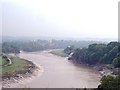
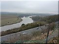
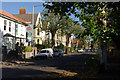
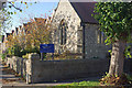
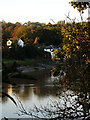
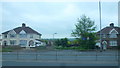
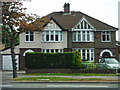
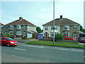

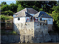
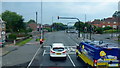
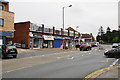
100 photos from this area
Area Information
Key information about the BS11 9XN including its size, population, and administrative classification.
- Area Type
- Postcode
- Area Size
- 7824 m²
- Population
- Not available
- Population Density
- Not available
House Prices in BS11 9XN
18
Properties
£184,050
Average Sold Price
£48,500
Lowest Price
£332,500
Highest Price
Showing 18 properties
| Address | Type | Beds | Baths | Last Sale Price | Last Sale Date | |
|---|---|---|---|---|---|---|
| 138 Nibley Road, Shirehampton, Bristol, BS11 9XN | Bungalow | 2 | 1 | £332,500 | Apr 2024 | |
| 125 Nibley Road, Shirehampton, Bristol, BS11 9XN | Retail | 3 | - | £310,000 | Mar 2022 | |
| 128 Nibley Road, Shirehampton, Bristol, BS11 9XN | Terraced | 4 | 1 | £232,000 | Jul 2016 | |
| 136 Nibley Road, Shirehampton, Bristol, BS11 9XN | house | - | - | £185,000 | Mar 2016 | |
| 150 Nibley Road, Shirehampton, Bristol, BS11 9XN | house | - | - | £183,500 | May 2014 | |
| 131 Nibley Road, Shirehampton, Bristol, BS11 9XN | Terraced | 3 | 1 | £175,000 | May 2014 | |
| 148 Nibley Road, Shirehampton, Bristol, BS11 9XN | house | - | - | £165,000 | Oct 2009 | |
| 129 Nibley Road, Shirehampton, Bristol, BS11 9XN | house | 2 | - | £148,000 | Jun 2006 | |
| 144 Nibley Road, Shirehampton, Bristol, BS11 9XN | Semi-detached | 2 | 1 | £61,000 | Apr 1999 | |
| 152 Nibley Road, Shirehampton, Bristol, BS11 9XN | Terraced | - | - | £48,500 | Nov 1997 |
Page 1 of 2
Energy Efficiency in BS11 9XN
Amenities
Schools
| Rank | School | Type | Entry gender | Ages |
|---|
Explore more schools in this area
Go to Schools tabDemographics
Household Size
Two person
most common
Accommodation Type
Houses
most common
Tenure
66
majority
Ethnic Group
White
most common
Religion
N/A
most common
Household Composition
N/A
most common
Age
47
median
Adults (30-64 years)
most common
Household Deprivation
N/A
with no deprivation
NS-SEC
31
in Lower managerial occupations
Explore more demographic insights in this area
Go to Demographics tabPlanning
Planning Constraints
- Flood RiskPremium
- Ramsar Wetland SitesPremium
- Area of Outstanding Natural BeautyPremium
- Protected Nature ReservePremium
- Protected WoodlandPremium