Area Overview for BS11 9TF
Photos of BS11 9TF

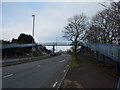


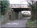
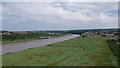


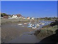
100 photos from this area
Area Information
Key information about the BS11 9TF including its size, population, and administrative classification.
- Area Type
- Postcode
- Area Size
- 1.6 hectares
- Population
- Not available
- Population Density
- Not available
House Prices in BS11 9TF
40
Properties
£201,107
Average Sold Price
£45,000
Lowest Price
£330,000
Highest Price
Showing 40 properties
| Address | Type | Beds | Baths | Last Sale Price | Last Sale Date | |
|---|---|---|---|---|---|---|
| 79 Priory Road, Shirehampton, Bristol, BS11 9TF | Terraced | 3 | 1 | £327,500 | Aug 2025 | |
| 23 Priory Road, Shirehampton, Bristol, BS11 9TF | Terraced | 3 | 2 | £325,000 | Aug 2025 | |
| 13 Priory Road, Shirehampton, Bristol, BS11 9TF | Terraced | 3 | 1 | £320,000 | May 2025 | |
| 27 Priory Road, Shirehampton, Bristol, BS11 9TF | Terraced | 3 | 1 | £330,000 | Jun 2024 | |
| 49 Priory Road, Shirehampton, Bristol, BS11 9TF | Terraced | 3 | 1 | £320,000 | Apr 2024 | |
| 37 Priory Road, Shirehampton, Bristol, BS11 9TF | Terraced | 3 | 1 | £217,000 | Dec 2022 | |
| 47 Priory Road, Shirehampton, Bristol, BS11 9TF | house | 3 | 1 | £315,000 | Sep 2022 | |
| 3 Priory Road, Shirehampton, Bristol, BS11 9TF | house | 3 | - | £290,000 | Jan 2022 | |
| 43 Priory Road, Shirehampton, Bristol, BS11 9TF | Terraced | 3 | 1 | £285,000 | Aug 2021 | |
| 15 Priory Road, Shirehampton, Bristol, BS11 9TF | house | 3 | 1 | £245,000 | Jan 2020 |
Page 1 of 4
Energy Efficiency in BS11 9TF
Amenities
Schools
| Rank | School | Type | Entry gender | Ages |
|---|
Explore more schools in this area
Go to Schools tabDemographics
Household Size
Two person
most common
Accommodation Type
Houses
most common
Tenure
80
majority
Ethnic Group
White
most common
Religion
N/A
most common
Household Composition
N/A
most common
Age
47
median
Adults (30-64 years)
most common
Household Deprivation
N/A
with no deprivation
NS-SEC
34
in Lower managerial occupations
Explore more demographic insights in this area
Go to Demographics tabPlanning
Planning Constraints
- Flood RiskPremium
- Ramsar Wetland SitesPremium
- Area of Outstanding Natural BeautyPremium
- Protected Nature ReservePremium
- Protected WoodlandPremium