Area Overview for BS11 0BT
Photos of BS11 0BT
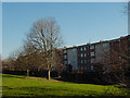

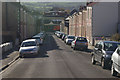
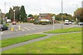
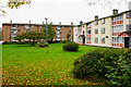
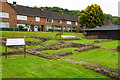
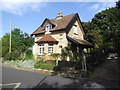
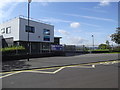
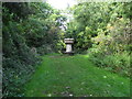
63 photos from this area
Area Information
Key information about the BS11 0BT including its size, population, and administrative classification.
- Area Type
- Postcode
- Area Size
- 6294 m²
- Population
- 1670
- Population Density
- 3602 people/km²
House Prices in BS11 0BT
23
Properties
£202,107
Average Sold Price
£48,500
Lowest Price
£300,000
Highest Price
Showing 23 properties
| Address | Type | Beds | Baths | Last Sale Price | Last Sale Date | |
|---|---|---|---|---|---|---|
| 27 Hermitage Close, Shirehampton, Bristol, BS11 0BT | Terraced | 3 | 1 | £261,250 | Feb 2025 | |
| 1B Hermitage Close, Shirehampton, Bristol, BS11 0BT | Terraced | 2 | 2 | £262,500 | Nov 2024 | |
| 7 Hermitage Close, Shirehampton, Bristol, BS11 0BT | Terraced | 3 | 1 | £265,000 | Aug 2023 | |
| 9 Hermitage Close, Shirehampton, Bristol, BS11 0BT | Terraced | 3 | 1 | £300,000 | Feb 2023 | |
| 11 Hermitage Close, Shirehampton, Bristol, BS11 0BT | Terraced | 3 | 1 | £243,000 | Feb 2020 | |
| 6 Hermitage Close, Shirehampton, Bristol, BS11 0BT | Terraced | 3 | 1 | £235,000 | Jan 2020 | |
| 2 Hermitage Close, Shirehampton, Bristol, BS11 0BT | Terraced | 3 | 1 | £185,000 | Nov 2018 | |
| 8 Hermitage Close, Shirehampton, Bristol, BS11 0BT | Terraced | 3 | 1 | £189,950 | Dec 2015 | |
| 13 Hermitage Close, Shirehampton, Bristol, BS11 0BT | Terraced | 3 | 1 | £180,000 | Nov 2015 | |
| 5 Hermitage Close, Shirehampton, Bristol, BS11 0BT | Terraced | 3 | - | £181,800 | Jul 2014 |
Page 1 of 3
Energy Efficiency in BS11 0BT
Amenities
Schools
| Rank | School | Type | Entry gender | Ages |
|---|
Explore more schools in this area
Go to Schools tabDemographics
Household Size
One person
most common
Accommodation Type
Houses
most common
Tenure
47
majority
Ethnic Group
White
most common
Religion
N/A
most common
Household Composition
N/A
most common
Age
47
median
Adults (30-64 years)
most common
Household Deprivation
N/A
with no deprivation
NS-SEC
25
in Lower managerial occupations
Explore more demographic insights in this area
Go to Demographics tabPlanning
Planning Constraints
- Flood RiskPremium
- Ramsar Wetland SitesPremium
- Area of Outstanding Natural BeautyPremium
- Protected Nature ReservePremium
- Protected WoodlandPremium