Area Overview for BS10 7UA
Photos of BS10 7UA

Area Information
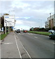
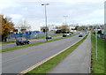
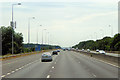
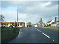
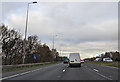
BS10 7UA is a small, tightly knit residential area in England, covering just 2.3 hectares and home to 2,353 people. Its compact size and low population density of 114 people per square kilometre create a quiet, suburban feel, typical of areas near major transport corridors. Located in the historic parish of Almondsbury, it lies along the A38 road, a key route between Bristol and Gloucester, and is near junction 16 of the M5 motorway. This positioning blends historical significance with modern connectivity. The area’s residents, predominantly adults aged 30–64, reflect a mature demographic, with 77% owning their homes. The cluster of houses, rather than flats, suggests a stable, long-term community. While small, the area benefits from proximity to infrastructure like the M4/M5 Almondsbury Interchange, a landmark motorway crossing. Daily life here balances quiet living with access to nearby amenities, including retail, rail, and ferry services. The presence of Highdene School, an independent institution, adds to the area’s appeal for families seeking private education.
- Area Type
- Postcode
- Area Size
- 2.3 hectares
- Population
- 2353
- Population Density
- 114 people/km²
BS10 7UA is a predominantly owner-occupied area, with 77% of homes owned by residents rather than rented. The housing stock is largely composed of houses, which is typical of suburban areas with lower population density. This suggests a market skewed towards family homes, with fewer apartments or flats. Given the area’s small size (2.3 hectares) and limited number of properties, the housing stock is likely constrained, making it a niche market for buyers seeking spacious, long-term residences. The high home ownership rate indicates a community of established residents, which may reduce turnover and competition for properties. However, buyers should consider the proximity to major infrastructure like the M5 motorway, which could influence property values and desirability. The focus on houses also implies that the area may not cater to those seeking rental properties or smaller living spaces.
House Prices in BS10 7UA
Showing 1 properties
| Address | Type | Beds | Baths | Last Sale Price | Last Sale Date | |
|---|---|---|---|---|---|---|
| Caspian Networks Ltd, Mcdonalds, Lysander Road, Almondsbury, BS10 7UA | restaurant_cafe | - | - | - | - |
Energy Efficiency in BS10 7UA
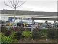
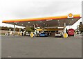
Residents of BS10 7UA have access to a range of amenities within practical reach. Retail options include major supermarkets like Morrisons Patchway, Makro Bristol, and Asda Patchway, ensuring everyday shopping needs are met. The area’s rail network, with stations such as Patchway and Filton Abbey Wood, connects to broader transport systems, while ferry landings at Bristol Docks and Castle Park offer scenic and functional travel options. The presence of Bristol Filton Airport adds to the area’s connectivity. For leisure, the historic village of Almondsbury offers a preserved village centre with landmarks like St Mary the Virgin church and the Bowl Inn. The surrounding landscape, including Almondsbury Hill, provides geographical character, though specific parks or recreational spaces are not detailed in the data. The blend of retail, transport, and historical sites supports a lifestyle that balances convenience with suburban tranquillity.
Amenities
Schools
The nearest school to BS10 7UA is Highdene School, an independent institution. While no Ofsted rating is provided, the presence of an independent school suggests the area may attract families prioritising private education. However, the lack of state schools in the immediate vicinity means families relying on public education would need to look further afield. This could be a consideration for buyers, as the school mix here is limited to one private option. The absence of additional schools in the data indicates that the area may not be ideal for those requiring a range of educational choices. Parents should factor in travel time to other schools in nearby towns like Bristol or Gloucester, which may offer more comprehensive options.
| Rank | School | Type | Entry gender | Ages |
|---|
Explore more schools in this area
Go to Schools tabDemographics
The population of BS10 7UA is 2,353, with a median age of 47 and the majority of residents aged 30–64. This suggests a community of established professionals and families, with fewer young people or retirees. Home ownership is high at 77%, indicating a stable, long-term resident base. The area is predominantly composed of houses rather than flats, aligning with the demographic profile of older, family-oriented households. The predominant ethnic group is White, reflecting the broader trends in the region. With a population density of 114 people per square kilometre, the area remains low-density, offering spacious living conditions. The absence of specific deprivation data means the quality of life is inferred from the stability of home ownership and the presence of essential amenities. The age profile and ownership rates suggest a community focused on comfort and continuity, with limited turnover of residents.
Household Size
Accommodation Type
Tenure
Ethnic Group
Religion
Household Composition
Age
Household Deprivation
NS-SEC
Explore more demographic insights in this area
Go to Demographics tabPlanning
Planning Constraints
- Flood RiskPremium
- Ramsar Wetland SitesPremium
- Area of Outstanding Natural BeautyPremium
- Protected Nature ReservePremium
- Protected WoodlandPremium