Area Overview for BS10 7NJ
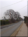
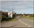
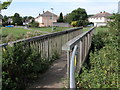
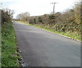
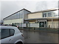
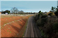
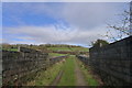
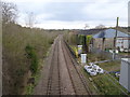
Photos of BS10 7NJ
Area Information
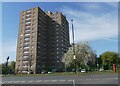
BS10 7NJ lies within the Henbury & Brentry ward of Bristol, a suburb shaped by post-war development and historical roots. With a population of 1,986 and a density of 1,352 people per square kilometre, this small postcode area blends council housing estates from the 1950s-1960s, Victorian homes, and newer private properties. Once a rural village, Henbury is now a northern Bristol suburb bordered by Westbury-on-Trym and the Blaise Castle Estate. Daily life here combines suburban convenience with proximity to natural spaces like Royal Victoria Park. The area’s character reflects its transition from a farming community to a modern residential hub, with landmarks such as the Grade II* listed St Mary the Virgin church and the National Trust’s Blaise Hamlet. Its mix of housing types and historical layers makes it a distinctive choice for those seeking a settled, community-oriented lifestyle in a city setting.
- Area Type
- Postcode
- Area Size
- Not available
- Population
- 1986
- Population Density
- 1352 people/km²
The property market in BS10 7NJ is characterised by a 68% home ownership rate, with houses forming the predominant accommodation type. This indicates a largely owner-occupied area, distinct from high-rental zones, and suggests a focus on long-term residency rather than transient tenancies. The housing stock includes post-war council estates, 1950s-1960s high-rise flats, and private homes, creating a varied but cohesive mix. For buyers, this means a range of property types to choose from, though the small postcode area limits the immediate availability of new builds. The presence of established homes and the area’s suburban appeal may attract those seeking a balance between urban accessibility and residential tranquillity. Proximity to transport links and amenities further enhances its appeal, though the compact size of the postcode means buyers should consider nearby areas for broader options.
House Prices in BS10 7NJ
No properties found in this postcode.
Energy Efficiency in BS10 7NJ
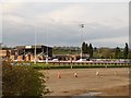
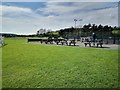
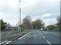
Residents of BS10 7NJ enjoy a mix of retail, transport, and recreational amenities within easy reach. The area hosts five retail outlets, including Co-op Henbury, Aldi Henbury, and Iceland Henbury, ensuring everyday shopping needs are met locally. Five railway stations and five ferry landings provide multiple routes for commuting or leisure travel, while Bristol Filton Airport offers regional flight connections. Nearby Royal Victoria Park, a historic site once known as Brentry House, offers green space for walks or relaxation. The blend of suburban living with access to urban amenities creates a convenient lifestyle, balancing local convenience with the ability to engage with Bristol’s cultural and commercial hubs. The proximity to Blaise Castle Estate and the National Trust’s Blaise Hamlet also adds historical and scenic value to daily life.
Amenities
Schools
Residents of BS10 7NJ have access to a range of schools, including Henbury School, which operates as both a primary school and an academy, and Blaise High School, an academy with a ‘good’ Ofsted rating. Special educational needs are catered to by Woodstock School and Henbury Manor School, both designated as special schools. This diversity in school types ensures families can choose between mainstream education and specialist provision. The presence of multiple schools within the area reduces the need for long commutes, supporting a family-friendly environment. While no data on school performance beyond Ofsted ratings is provided, the inclusion of a rated academy like Blaise High suggests at least one institution meets higher standards. Parents should verify current inspection reports and pupil outcomes for a fuller picture of educational quality.
| Rank | School | Type | Entry gender | Ages |
|---|
Explore more schools in this area
Go to Schools tabDemographics
The population of BS10 7NJ has a median age of 47, with the majority aged between 30 and 64. This suggests a mature, stable community with a strong presence of working-age adults. Home ownership stands at 68%, indicating a significant proportion of residents live in their own homes, while the remaining 32% are likely to be renters or in mixed tenure arrangements. The accommodation type is predominantly houses, which aligns with the area’s suburban layout and post-war housing stock. The predominant ethnic group is White, reflecting the broader demographic trends of the Bristol region. While specific data on deprivation is not provided, the high home ownership rate and moderate population density suggest a relatively stable quality of life, though the absence of detailed socioeconomic metrics means further local research would be necessary to fully assess living standards.
Household Size
Accommodation Type
Tenure
Ethnic Group
Religion
Household Composition
Age
Household Deprivation
NS-SEC
Explore more demographic insights in this area
Go to Demographics tabPlanning
Planning Constraints
- Flood RiskPremium
- Ramsar Wetland SitesPremium
- Area of Outstanding Natural BeautyPremium
- Protected Nature ReservePremium
- Protected WoodlandPremium