Area Overview for BS10 7DH
Photos of BS10 7DH
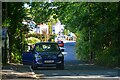
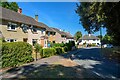
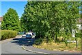
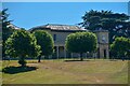
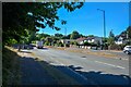
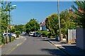
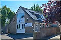
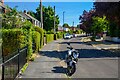
45 photos from this area
Area Information
Key information about the BS10 7DH including its size, population, and administrative classification.
- Area Type
- Postcode
- Area Size
- 8745 m²
- Population
- 1836
- Population Density
- 5555 people/km²
House Prices in BS10 7DH
30
Properties
£170,914
Average Sold Price
£39,000
Lowest Price
£249,000
Highest Price
Showing 30 properties
| Address | Type | Beds | Baths | Last Sale Price | Last Sale Date | |
|---|---|---|---|---|---|---|
| 45 Westacre Close, Henbury, Bristol, BS10 7DH | Flat | 2 | 1 | £197,500 | May 2025 | |
| 33 Westacre Close, Henbury, Bristol, BS10 7DH | Flat | - | - | £216,000 | Jul 2024 | |
| 29 Westacre Close, Henbury, Bristol, BS10 7DH | Flat | - | - | £249,000 | Feb 2024 | |
| 49 Westacre Close, Henbury, Bristol, BS10 7DH | Flat | - | - | £225,000 | Nov 2023 | |
| 30 Westacre Close, Henbury, Bristol, BS10 7DH | Flat | - | - | £205,000 | Jul 2023 | |
| 41 Westacre Close, Henbury, Bristol, BS10 7DH | Flat | - | - | £210,000 | Jun 2023 | |
| 40 Westacre Close, Henbury, Bristol, BS10 7DH | Flat | 3 | 1 | £227,000 | Oct 2022 | |
| 44 Westacre Close, Henbury, Bristol, BS10 7DH | Flat | - | - | £196,000 | Jan 2022 | |
| 28 Westacre Close, Henbury, Bristol, BS10 7DH | Flat | - | - | £207,000 | Jan 2022 | |
| 26 Westacre Close, Henbury, Bristol, BS10 7DH | Flat | - | - | £210,000 | Jun 2021 |
Page 1 of 3
Energy Efficiency in BS10 7DH
Amenities
Schools
| Rank | School | Type | Entry gender | Ages |
|---|
Explore more schools in this area
Go to Schools tabDemographics
Household Size
Family (3-5 people)
most common
Accommodation Type
Houses
most common
Tenure
49
majority
Ethnic Group
White
most common
Religion
N/A
most common
Household Composition
N/A
most common
Age
47
median
Adults (30-64 years)
most common
Household Deprivation
N/A
with no deprivation
NS-SEC
24
in Lower managerial occupations
Explore more demographic insights in this area
Go to Demographics tabPlanning
Planning Constraints
- Flood RiskPremium
- Ramsar Wetland SitesPremium
- Area of Outstanding Natural BeautyPremium
- Protected Nature ReservePremium
- Protected WoodlandPremium