Area Overview for BS10 7BZ
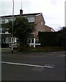
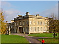
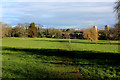
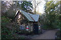
Photos of BS10 7BZ


Area Information
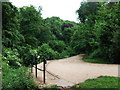
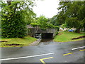
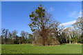
Living in BS10 7BZ means being part of a small, residential cluster within the City of Bristol, where history and modernity intersect. The area, part of the Henbury & Brentry ward, was once a rural village but has evolved into a suburban hub. With a population of 1,836, it reflects a blend of post-war development, including 1950s-1960s high-rise flats and Victorian homes, alongside newer private housing. Proximity to Bristol’s core offers easy access to the city’s cultural and economic life, while nearby landmarks like Blaise Castle Estate and Royal Victoria Park provide green spaces. Residents benefit from a mix of local amenities, including retail outlets, rail links, and ferry services, making it a practical choice for commuters. The area’s character is defined by its suburban layout, historical roots, and connectivity to Bristol’s transport networks, offering a balance of convenience and community.
- Area Type
- Postcode
- Area Size
- Not available
- Population
- 1836
- Population Density
- 5555 people/km²
The property market in BS10 7BZ is characterised by a 49% home ownership rate, with houses making up the majority of accommodation types. This suggests a mix of owner-occupied and rental properties, though the relatively low home ownership rate may indicate a higher proportion of renters or a more transient population. The area’s housing stock includes post-war council estates, Victorian homes, and newer private developments, reflecting its history as a suburban expansion of Bristol. Buyers should note the limited size of the area, which may restrict property options, though nearby suburbs like Westbury-on-Trym and Blaise Castle Estate could offer additional choices. The presence of both older and newer housing stock means buyers may find a range of property styles, though the small postcode area limits scope for large-scale market trends.
House Prices in BS10 7BZ
No properties found in this postcode.
Energy Efficiency in BS10 7BZ
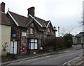
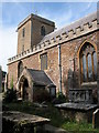
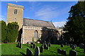
Residents of BS10 7BZ have access to a range of amenities within practical reach. Local retail options include Aldi Henbury, Iceland Henbury, and Co-op Crow, offering everyday shopping needs. The area’s proximity to rail stations and ferry landings ensures convenient travel, while nearby parks like Royal Victoria Park provide green space for recreation. Historical sites such as the Grade II* listed Church of St Mary the Virgin and Blaise Castle Estate add cultural value. The mix of retail, transport, and leisure options supports a practical lifestyle, though the area’s suburban character means it is more focused on convenience than large-scale entertainment.
Amenities
Schools
The nearest school to BS10 7BZ is Blaise Primary and Nursery School, a primary school with a ‘good’ Ofsted rating. This provides families with a locally rated education option for younger children, though no secondary schools are listed in the data. The presence of a primary school with a strong rating suggests a focus on early education, but parents seeking secondary schooling may need to look beyond the immediate area. The school’s proximity to residential clusters makes it a practical choice for local families, though the lack of secondary schools nearby could influence decisions about long-term housing.
| Rank | School | Type | Entry gender | Ages |
|---|
Explore more schools in this area
Go to Schools tabDemographics
BS10 7BZ has a median age of 47, with the majority of residents aged 30–64. This suggests a mature, stable population, likely with established careers and families. Home ownership stands at 49%, indicating a mix of owner-occupied properties and rental homes. The predominant accommodation type is houses, reflecting a suburban rather than high-density residential profile. The predominant ethnic group is White, though no specific diversity statistics are provided. The age profile and home ownership rate suggest a community focused on long-term residency, with a moderate proportion of younger households seeking stability. The absence of detailed deprivation data means quality of life factors like access to services and infrastructure must be inferred from available amenities and connectivity.
Household Size
Accommodation Type
Tenure
Ethnic Group
Religion
Household Composition
Age
Household Deprivation
NS-SEC
Explore more demographic insights in this area
Go to Demographics tabPlanning
Planning Constraints
- Flood RiskPremium
- Ramsar Wetland SitesPremium
- Area of Outstanding Natural BeautyPremium
- Protected Nature ReservePremium
- Protected WoodlandPremium