Area Overview for BS10 6YW
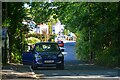
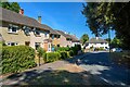
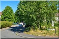
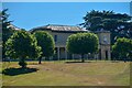
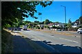
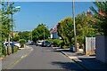
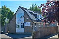
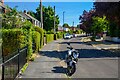
Photos of BS10 6YW
Area Information
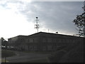
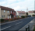
Living in BS10 6YW means being part of a small, tightly knit residential cluster in Bristol’s northern suburbs. With a population of 2,005, this area is characterised by its compact nature, centred around coordinates 51.497862, -2.596773. Historically developed as a council estate in 1931 to address a housing crisis, the area retains a distinct identity shaped by its origins. Southmead Hospital, a major local landmark, dominates the landscape, with its 800-bed Brunel Building opened in 2014. Nearby, Badock’s Wood holds a Bronze Age barrow, a relic dating to the time of the Egyptian pyramids. Daily life here balances modern amenities with historical context, offering residents proximity to healthcare, transport networks, and a mix of retail and leisure options within practical reach. The area’s small size fosters a sense of community, though its limited scale means residents often look to nearby suburbs for broader services. For those seeking a quiet, established residential environment with access to essential infrastructure, BS10 6YW provides a blend of practicality and local heritage.
- Area Type
- Postcode
- Area Size
- Not available
- Population
- 2005
- Population Density
- 3257 people/km²
The property market in BS10 6YW is defined by its 56% home ownership rate, indicating a majority of properties are owner-occupied rather than rented. The accommodation type is predominantly houses, which contrasts with areas dominated by flats or apartments. This suggests a focus on family homes and long-term residency, with limited scope for high-density development. Given the area’s small size and the presence of established infrastructure like Southmead Hospital, the housing stock is likely to be mature, with older properties forming the bulk of the market. Buyers considering this area should note that the limited scale of the postcode may restrict availability, and proximity to larger suburbs could be necessary for additional options. The lack of specific data on property prices or rental yields means the market’s dynamics remain opaque, but the emphasis on houses implies a preference for spacious, traditional living arrangements over newer, more compact alternatives.
House Prices in BS10 6YW
No properties found in this postcode.
Energy Efficiency in BS10 6YW
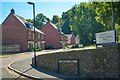
The lifestyle in BS10 6YW is shaped by its proximity to a range of amenities, including five retail outlets such as Aldi Southmead, Iceland Southmead 1, and Morrisons Daily, which provide everyday shopping convenience. The area’s rail network, with stations like Filton Abbey Wood and Sea Mills, ensures easy access to Bristol’s broader transport system, while ferry services connect residents to the city’s waterways. The nearby Bristol Filton Airport adds to the area’s connectivity. Though the data does not specify parks or leisure facilities, the presence of Badock’s Wood—a site with a Bronze Age barrow—suggests some green space for recreation. The mix of retail, transport, and healthcare infrastructure (via Southmead Hospital) creates a practical, service-oriented environment. However, the absence of detailed information on leisure options means residents may need to look further afield for cultural or recreational activities.
Amenities
Schools
Residents of BS10 6YW have access to a range of primary and special schools, including Embleton Junior School, Embleton Infant School, Badocks Wood Primary School, Doncaster Road Junior School, and Elmfield School for Deaf Children. These institutions cater to a mix of general and specialist educational needs, providing families with options for both mainstream and tailored learning environments. The presence of a special school highlights the area’s capacity to support diverse student requirements, though specific Ofsted ratings are not included in the data. The clustering of primary schools suggests a focus on early education, which may be advantageous for families with young children. However, the absence of secondary schools within the immediate area means students may need to travel to nearby suburbs for further education. This mix of school types reflects a practical approach to education, balancing accessibility with specialised resources.
| Rank | School | Type | Entry gender | Ages |
|---|
Explore more schools in this area
Go to Schools tabDemographics
The community in BS10 6YW is predominantly middle-aged, with a median age of 47 and the majority of residents falling within the 30-64 age range. Home ownership stands at 56%, indicating a mix of owner-occupied properties and rental stock, though the exact proportion of renters is not specified. The area is characterised by houses rather than flats, reflecting a traditional residential layout. The predominant ethnic group is White, though specific diversity metrics are not provided. The population size of 2,005 suggests a small, close-knit community, which may influence social dynamics and local services. While the data does not include deprivation scores, the presence of essential amenities like schools, retail, and transport links implies a baseline level of accessibility. However, the median age and home ownership rate suggest a stable, long-term resident base rather than a transient population.
Household Size
Accommodation Type
Tenure
Ethnic Group
Religion
Household Composition
Age
Household Deprivation
NS-SEC
Explore more demographic insights in this area
Go to Demographics tabPlanning
Planning Constraints
- Flood RiskPremium
- Ramsar Wetland SitesPremium
- Area of Outstanding Natural BeautyPremium
- Protected Nature ReservePremium
- Protected WoodlandPremium