Area Overview for BS10 6PP
Photos of BS10 6PP
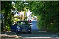
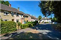
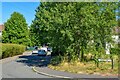

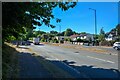
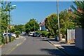
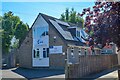
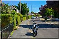
45 photos from this area
Area Information
Key information about the BS10 6PP including its size, population, and administrative classification.
- Area Type
- Postcode
- Area Size
- 6785 m²
- Population
- 1720
- Population Density
- 5102 people/km²
House Prices in BS10 6PP
31
Properties
£186,983
Average Sold Price
£91,000
Lowest Price
£340,000
Highest Price
Showing 31 properties
| Address | Type | Beds | Baths | Last Sale Price | Last Sale Date | |
|---|---|---|---|---|---|---|
| 66 Twenty Acres Road, Southmead, Bristol, BS10 6PP | Detached | 3 | 2 | £315,000 | Jul 2025 | |
| 61 Twenty Acres Road, Southmead, Bristol, BS10 6PP | Semi-detached | 3 | 1 | £340,000 | Sep 2023 | |
| 86 Twenty Acres Road, Southmead, Bristol, BS10 6PP | Flat | - | - | £135,500 | Apr 2021 | |
| 74 Twenty Acres Road, Southmead, Bristol, BS10 6PP | house | - | - | £223,000 | Apr 2021 | |
| 70 Twenty Acres Road, Southmead, Bristol, BS10 6PP | Detached | 3 | 1 | £180,500 | Feb 2020 | |
| 59 Twenty Acres Road, Southmead, Bristol, BS10 6PP | Detached | 3 | 1 | £227,500 | Sep 2018 | |
| 60 Twenty Acres Road, Southmead, Bristol, BS10 6PP | Detached | 4 | - | £135,000 | Jan 2015 | |
| 69 Twenty Acres Road, Southmead, Bristol, BS10 6PP | Detached | - | - | £159,000 | Apr 2008 | |
| 75 Twenty Acres Road, Southmead, Bristol, BS10 6PP | Terraced | 3 | 2 | £150,000 | May 2007 | |
| 63 Twenty Acres Road, Southmead, Bristol, BS10 6PP | house | 4 | - | £160,300 | Apr 2007 |
Page 1 of 4
Energy Efficiency in BS10 6PP
Amenities
Schools
| Rank | School | Type | Entry gender | Ages |
|---|
Explore more schools in this area
Go to Schools tabDemographics
Household Size
Family (3-5 people)
most common
Accommodation Type
Houses
most common
Tenure
54
majority
Ethnic Group
White
most common
Religion
N/A
most common
Household Composition
N/A
most common
Age
47
median
Adults (30-64 years)
most common
Household Deprivation
N/A
with no deprivation
NS-SEC
23
in Lower managerial occupations
Explore more demographic insights in this area
Go to Demographics tabPlanning
Planning Constraints
- Flood RiskPremium
- Ramsar Wetland SitesPremium
- Area of Outstanding Natural BeautyPremium
- Protected Nature ReservePremium
- Protected WoodlandPremium