Area Overview for BS10 6NH
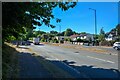
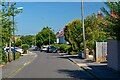
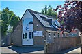
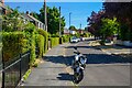
Photos of BS10 6NH
Area Information
BS10 6NH lies within the northern suburbs of Bristol, a small residential cluster centred around the Southmead area. With a population of 2,005, it is a compact community shaped by its history as a 1930s council estate addressing Bristol’s housing needs. The area is defined by its proximity to Southmead Hospital, a major healthcare hub, and Badock’s Wood, home to a Bronze Age barrow dating to the time of the Egyptian pyramids. Daily life here is influenced by the presence of the hospital, which anchors the local economy, and the surrounding residential streets that blend modest homes with green spaces. The area’s mix of historical significance and modern infrastructure offers a quiet, functional lifestyle. Residents benefit from nearby transport links, including rail stations and ferry routes, while the community’s age profile—predominantly adults aged 30–64—suggests a stable, family-oriented demographic. Living in BS10 6NH means being close to essential services, with a focus on practicality over luxury.
- Area Type
- Postcode
- Area Size
- Not available
- Population
- 2005
- Population Density
- 3257 people/km²
The property market in BS10 6NH is characterised by a 56% home ownership rate, with houses forming the predominant accommodation type. This suggests a residential area where owner-occupation is common, though a significant portion of the housing stock may be rented. The small size of the postcode area means the market is limited in scope, with properties likely to be older, reflecting the area’s origins as a 1930s council estate. Buyers should consider the proximity to Southmead Hospital and the surrounding infrastructure, which may influence property values. The lack of high-rise or commercial developments points to a low-density, family-friendly environment. For those seeking homes in BS10 6NH, the focus is on practical, established housing rather than speculative investment. The market is likely to cater to those prioritising stability and access to healthcare and transport over rapid capital growth.
House Prices in BS10 6NH
No properties found in this postcode.
Energy Efficiency in BS10 6NH
The lifestyle in BS10 6NH is shaped by its proximity to retail, transport, and green spaces. Nearby shops include M&S Falcondale BP, Aldi Southmead, and Iceland Southmead 1, offering everyday essentials. The area’s rail and ferry links provide easy access to Bristol’s cultural and commercial hubs, while the nearby airport caters to travel needs. Green spaces such as Badock’s Wood, with its Bronze Age barrow, offer historical and recreational value. The presence of Southmead Hospital adds a healthcare dimension to daily life. The mix of practical amenities and historical sites creates a balanced environment, where residents can enjoy both modern conveniences and a connection to the past. The area’s compact size ensures that essential services are within walking or cycling distance, fostering a community-oriented lifestyle.
Amenities
Schools
Residents of BS10 6NH have access to a range of educational institutions, including primary schools such as Embleton Junior School, Embleton Infant School, Badocks Wood Primary School, and Doncaster Road Junior School. Elmfield School for Deaf Children provides specialist education for students with hearing impairments. The mix of primary schools and a special needs institution indicates a comprehensive educational offering for families. The presence of multiple primary schools within walking distance suggests strong local provision for younger children, while the specialist school highlights the area’s capacity to support diverse educational needs. For families, this means proximity to schools that cater to both general and specific requirements, reducing the need for long commutes. The density of schools also implies a community-focused approach to education, with resources and facilities accessible to nearby residents.
| Rank | School | Type | Entry gender | Ages |
|---|
Explore more schools in this area
Go to Schools tabDemographics
The population of BS10 6NH has a median age of 47, with the majority of residents aged between 30 and 64. This suggests a mature, established community with a strong presence of working-age adults. Home ownership in the area stands at 56%, indicating a mix of owner-occupied properties and rental units. The predominant accommodation type is houses, reflecting a residential character that contrasts with high-density housing. The predominant ethnic group is White, though specific data on diversity is not provided. The age profile and ownership figures suggest a stable, long-term resident base. While no deprivation data is available, the presence of schools, healthcare, and transport links implies access to essential services. The community’s demographic makeup supports a lifestyle focused on family living and local amenities rather than transient populations.
Household Size
Accommodation Type
Tenure
Ethnic Group
Religion
Household Composition
Age
Household Deprivation
NS-SEC
Explore more demographic insights in this area
Go to Demographics tabPlanning
Planning Constraints
- Flood RiskPremium
- Ramsar Wetland SitesPremium
- Area of Outstanding Natural BeautyPremium
- Protected Nature ReservePremium
- Protected WoodlandPremium