Area Overview for BS10 5SJ
Photos of BS10 5SJ

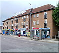
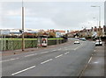
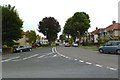
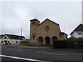
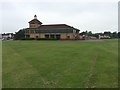
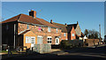
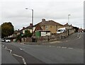
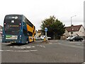

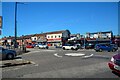
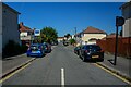
82 photos from this area
Area Information
Key information about the BS10 5SJ including its size, population, and administrative classification.
- Area Type
- Postcode
- Area Size
- 1.9 hectares
- Population
- 1748
- Population Density
- 6313 people/km²
House Prices in BS10 5SJ
30
Properties
£175,714
Average Sold Price
£34,000
Lowest Price
£295,000
Highest Price
Showing 30 properties
| Address | Type | Beds | Baths | Last Sale Price | Last Sale Date | |
|---|---|---|---|---|---|---|
| 39 Stanton Road, Southmead, Bristol, BS10 5SJ | house | - | - | £285,000 | Jun 2022 | |
| 27 Stanton Road, Southmead, Bristol, BS10 5SJ | Semi-detached | 3 | 1 | £281,000 | Feb 2022 | |
| 29 Stanton Road, Southmead, Bristol, BS10 5SJ | Terraced | 3 | 1 | £185,000 | Jun 2020 | |
| 25 Stanton Road, Southmead, Bristol, BS10 5SJ | Semi-detached | 3 | 1 | £210,000 | Mar 2020 | |
| 49 Stanton Road, Southmead, Bristol, BS10 5SJ | Semi-detached | 3 | 1 | £195,000 | Oct 2019 | |
| 61 Stanton Road, Southmead, Bristol, BS10 5SJ | Semi-detached | 3 | 1 | £295,000 | Apr 2018 | |
| 13 Stanton Road, Southmead, Bristol, BS10 5SJ | Terraced | 3 | 1 | £165,000 | Jul 2015 | |
| 51 Stanton Road, Southmead, Bristol, BS10 5SJ | Terraced | 3 | - | £162,000 | Jan 2014 | |
| 33 Stanton Road, Southmead, Bristol, BS10 5SJ | Terraced | 3 | 2 | £148,000 | Nov 2007 | |
| 69 Stanton Road, Southmead, Bristol, BS10 5SJ | Terraced | 3 | 1 | £136,000 | Jun 2007 |
Page 1 of 3
Energy Efficiency in BS10 5SJ
Amenities
Schools
| Rank | School | Type | Entry gender | Ages |
|---|
Explore more schools in this area
Go to Schools tabDemographics
Household Size
Family (3-5 people)
most common
Accommodation Type
Houses
most common
Tenure
44
majority
Ethnic Group
White
most common
Religion
N/A
most common
Household Composition
N/A
most common
Age
47
median
Adults (30-64 years)
most common
Household Deprivation
N/A
with no deprivation
NS-SEC
23
in Lower managerial occupations
Explore more demographic insights in this area
Go to Demographics tabPlanning
Planning Constraints
- Flood RiskPremium
- Ramsar Wetland SitesPremium
- Area of Outstanding Natural BeautyPremium
- Protected Nature ReservePremium
- Protected WoodlandPremium