Area Overview for BS10 5LA
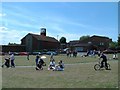
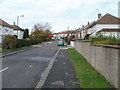
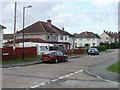
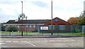
Photos of BS10 5LA
Area Information
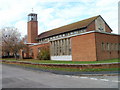
BS10 5LA is a small, tightly knit residential area in the northern suburbs of Bristol, centred around Southmead. With a population of 1,890, it balances modern living with historical roots, including a Bronze Age barrow and a site once occupied by Barton Regis Workhouse, later Southmead Hospital. The area is defined by its proximity to healthcare infrastructure, with the 800-bed Brunel Building at Southmead Hospital dominating the landscape. Daily life here is shaped by its accessibility to transport networks, including five railway stations and ferry landings, and its role as a hub for both local and regional connectivity. The postcode covers a compact cluster of homes, predominantly houses, reflecting a mix of owner-occupied and rental properties. While the area lacks natural conservation designations, its practical amenities and strategic location near Bristol Filton Airport make it appealing for commuters and families seeking a blend of suburban tranquillity and urban convenience.
- Area Type
- Postcode
- Area Size
- Not available
- Population
- 1890
- Population Density
- 7667 people/km²
The property market in BS10 5LA is characterised by a 38% home ownership rate, indicating that the majority of residents rent rather than own their homes. This suggests a rental market that may cater to professionals working in nearby sectors, such as healthcare or transport. The accommodation type is predominantly houses, which contrasts with areas dominated by flats or apartments. The small size of the postcode area means property availability is limited, and buyers should consider the immediate surrounding areas for more options. The presence of houses implies a family-friendly environment, though the lower home ownership rate may reflect affordability challenges or a preference for renting in a location with strong transport links. For buyers, this small cluster of homes offers a compact, focused market with clear boundaries.
House Prices in BS10 5LA
No properties found in this postcode.
Energy Efficiency in BS10 5LA
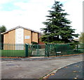
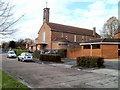
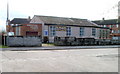
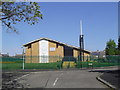
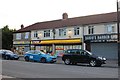
Living in BS10 5LA offers access to a range of practical amenities within easy reach. Retail options include Tesco Greystoke, Lidl Southmead, and M&S Southmead, providing everyday shopping convenience. The area’s transport links are extensive, with five railway stations and ferry landings facilitating quick travel to Bristol’s cultural and commercial hubs. While the postcode itself is small, its proximity to Southmead Hospital and historical sites like Badock’s Wood adds depth to the local environment. The presence of the Brunel Building, with its helipad and patient gardens, underscores the area’s healthcare focus. For residents, the blend of retail, transport, and historical interest creates a lifestyle that is both functional and rooted in the region’s heritage.
Amenities
Schools
| Rank | School | Type | Entry gender | Ages |
|---|
Explore more schools in this area
Go to Schools tabDemographics
The population of BS10 5LA has a median age of 47, with the largest age group being adults aged 30–64. This suggests a mature, stable community with a focus on established households. Home ownership stands at 38%, indicating a mix of owner-occupied properties and rental units. The area is predominantly composed of houses, reflecting a residential character distinct from high-density housing. The predominant ethnic group is White, though specific data on diversity beyond this category is not provided. The age profile and home ownership rate suggest a community that is neither young nor highly transient, with residents likely prioritising long-term stability. The absence of detailed deprivation data means the quality of life cannot be fully contextualised, but the demographic profile points to a balanced, middle-aged population with established local ties.
Household Size
Accommodation Type
Tenure
Ethnic Group
Religion
Household Composition
Age
Household Deprivation
NS-SEC
Explore more demographic insights in this area
Go to Demographics tabPlanning
Planning Constraints
- Flood RiskPremium
- Ramsar Wetland SitesPremium
- Area of Outstanding Natural BeautyPremium
- Protected Nature ReservePremium
- Protected WoodlandPremium