Area Overview for BS10 5FN
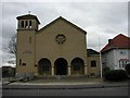
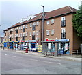
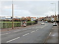
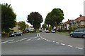
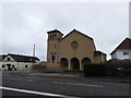
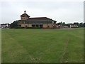
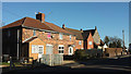
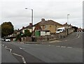
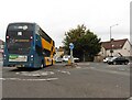
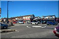
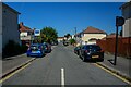
Photos of BS10 5FN

Area Information
BS10 5FN lies within the Horfield electoral ward in Bristol, a historically rural area that transformed into a suburban hub by the 20th century. This postcode covers 6,064 square metres, housing 1,229 residents in a densely populated cluster. With a population density of 202,656 people per square kilometre, the area is compact yet rich in character. Horfield’s name derives from Old English, reflecting its origins as a muddy expanse of open land. Today, it is defined by its proximity to Gloucester Road (A38), a key thoroughfare, and landmarks such as the Memorial Stadium, built in 1921 to commemorate wartime sacrifices. The area’s mix of historical infrastructure—like Horfield Barracks and Southmead Hospital—coexists with modern amenities. Daily life here is shaped by its small-scale residential layout, with a focus on local services and transport links. While the community is tightly knit, the high density means living spaces are closely packed, offering both convenience and the need for adaptability in urban living.
- Area Type
- Postcode
- Area Size
- 6064 m²
- Population
- Not available
- Population Density
- Not available
BS10 5FN is predominantly an owner-occupied area, with 58% of homes owned by residents rather than rented. The accommodation type is primarily houses, suggesting a focus on standalone properties rather than flats or terraced housing. This aligns with the area’s historical development as a suburban expansion of Bristol, where larger homes were built to accommodate growing families. The small size of the postcode—covering just 6,064 square metres—means the housing stock is limited, with properties likely concentrated around key thoroughfares like Gloucester Road (A38). For buyers, this implies a competitive market with limited new developments, where properties are likely to be well-established. The absence of rental data means it is unclear how many homes are available for lease, but the emphasis on ownership suggests a community prioritising long-term investment over transient occupancy.
House Prices in BS10 5FN
Showing 1 properties
| Address | Type | Beds | Baths | Last Sale Price | Last Sale Date | |
|---|---|---|---|---|---|---|
| Severn Pathology, Pathology Sciences Building, Southmead Road, Southmead, Bristol, BS10 5FN | commercial | - | - | - | - |
Energy Efficiency in BS10 5FN
Living in BS10 5FN offers access to a range of nearby amenities, including retail outlets such as Lidl Southmead, M&S Southmead, and Tesco Greystoke. These shops provide everyday essentials, while Gloucester Road (A38) acts as a central hub for local services. The area’s proximity to ferry landings like Welsh Back Ferry Landing and Castle Park Ferry Landing adds to its connectivity, enabling easy access to water-based transport. While the data does not specify dining or leisure venues, the presence of Southmead Hospital and the Memorial Stadium suggests a mix of healthcare and recreational facilities. The compact nature of the postcode means amenities are within practical reach, though the high population density may influence the availability of green spaces or larger public areas. The combination of retail, transport, and historical landmarks creates a lifestyle that balances convenience with the area’s heritage.
Amenities
Schools
The nearest school to BS10 5FN is St Teresa’s Catholic Primary School, which serves the area with a primary education offering. The school holds an Ofsted rating of ‘good’, indicating a satisfactory standard of teaching and facilities. As the only named school in the data, it is the primary educational option for local families. The absence of secondary schools or additional educational institutions means parents may need to consider commuting to nearby areas for further education. However, the presence of a well-rated primary school is a positive factor for families prioritising early education within the community. The school’s Catholic affiliation may align with the religious preferences of some residents, though no data on school catchment areas or student numbers is provided.
| Rank | School | Type | Entry gender | Ages |
|---|
Explore more schools in this area
Go to Schools tabDemographics
The median age in BS10 5FN is 47, with the majority of residents falling within the 30–64 age range. This suggests a mature, stable population, likely with established careers and families. Home ownership rates stand at 58%, indicating a mix of long-term residents and those seeking property in a historically significant area. The predominant accommodation type is houses, reflecting a preference for private, standalone living spaces. The predominant ethnic group is White, though no specific data on diversity or deprivation levels is provided. The age profile and ownership figures imply a community with a strong focus on family life and property investment. With no mention of rental market activity, the area appears to cater more to owner-occupiers than tenants. The absence of detailed diversity metrics means the full demographic picture remains incomplete, but the data available points to a cohesive, middle-aged population with a stake in local housing.
Household Size
Accommodation Type
Tenure
Ethnic Group
Religion
Household Composition
Age
Household Deprivation
NS-SEC
Explore more demographic insights in this area
Go to Demographics tabPlanning
Planning Constraints
- Flood RiskPremium
- Ramsar Wetland SitesPremium
- Area of Outstanding Natural BeautyPremium
- Protected Nature ReservePremium
- Protected WoodlandPremium