Area Overview for BS10 5BQ
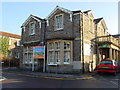
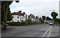
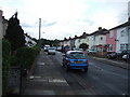
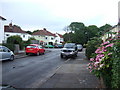
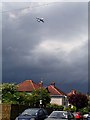
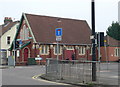
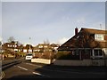
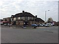
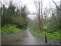
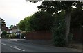
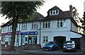
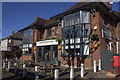
Photos of BS10 5BQ
Area Information
BS10 5BQ lies within the Horfield electoral ward of Bristol, a historic area with roots in the Domesday Book. This small residential postcode cluster has a population of 1,871, reflecting a tight-knit community. The area’s character is shaped by its transformation from rural farmland to a suburban hub, with Gloucester Road (A38) as its main thoroughfare. Today, it balances historical landmarks like Horfield Barracks and the Memorial Stadium with modern amenities. The median age of 47 suggests a mature demographic, with adults aged 30–64 forming the majority. Homeownership stands at 67%, indicating a stable residential base. Daily life here is defined by proximity to retail, transport, and green spaces, though the area’s compact size means residents often look to nearby wards for broader services. The presence of Southmead Hospital and the Horfield & District Allotments Association hints at a mix of practical and community-driven living. For those seeking a blend of heritage and convenience, BS10 5BQ offers a distinct slice of Bristol’s suburban fabric.
- Area Type
- Postcode
- Area Size
- Not available
- Population
- 1871
- Population Density
- 5073 people/km²
The property market in BS10 5BQ is characterised by a high rate of home ownership (67%) and a predominance of houses. This suggests a stable, owner-occupied market with limited rental activity. The compact nature of the postcode area means the housing stock is concentrated, potentially limiting availability for buyers. The presence of houses rather than flats indicates a focus on family-friendly living, with properties likely offering more space and garden areas. However, the small size of the area means buyers may need to consider nearby wards for a broader range of options. The market’s stability is reinforced by the area’s low flood risk and proximity to essential services. For those seeking a suburban home with historical character, BS10 5BQ offers a blend of traditional and practical housing, though competition for properties could be fierce due to its appeal.
House Prices in BS10 5BQ
No properties found in this postcode.
Energy Efficiency in BS10 5BQ
Life in BS10 5BQ is enriched by a range of nearby amenities, including five retail outlets such as Morrisons Daily, Tesco Bristol, and M&S Southmead. Gloucester Road (A38) serves as a central hub for shopping and dining. The area’s transport links extend to five rail stations, offering frequent services to key destinations. Ferries at Castle Park and Welsh Back provide water-based connectivity, while Bristol Filton Airport caters to those requiring air travel. Southmead Hospital and green spaces like Horfield Common (in Bishopston) add to the area’s practical and recreational appeal. The presence of historical sites such as the Memorial Stadium and Horfield Barracks adds character, though the compact size of the postcode means residents often venture to adjacent wards for more extensive leisure options. This blend of convenience and heritage defines the lifestyle in BS10 5BQ.
Amenities
Schools
The nearest school to BS10 5BQ is Horfield Church of England Primary School, which serves the local community with a primary education offering. Its Ofsted rating of “satisfactory” indicates adequate performance, though families may seek additional educational options beyond the primary level. The absence of secondary schools in the immediate vicinity means parents might need to consider nearby areas for secondary education. This mix of school types suggests that the area is well-suited for families with young children, but those planning for older children may need to look further afield. The presence of a primary school contributes to the area’s family-friendly appeal, though the lack of higher education facilities could be a consideration for some buyers.
| Rank | School | Type | Entry gender | Ages |
|---|
Explore more schools in this area
Go to Schools tabDemographics
The population of BS10 5BQ is 1,871, with a median age of 47, reflecting a community dominated by adults aged 30–64. Homeownership is high at 67%, suggesting a stable, long-term resident base. The area is predominantly White, with no data indicating significant ethnic diversity. The accommodation type is primarily houses, aligning with the suburban character of the ward. This demographic profile implies a mature, settled population with established ties to the area. The absence of specific deprivation data means quality of life indicators such as access to services and infrastructure are inferred from the availability of amenities like schools, transport, and retail. The age distribution suggests a community with a strong focus on family life, supported by local schools and green spaces. However, the lack of younger demographics may influence the social dynamics and long-term growth of the area.
Household Size
Accommodation Type
Tenure
Ethnic Group
Religion
Household Composition
Age
Household Deprivation
NS-SEC
Explore more demographic insights in this area
Go to Demographics tabPlanning
Planning Constraints
- Flood RiskPremium
- Ramsar Wetland SitesPremium
- Area of Outstanding Natural BeautyPremium
- Protected Nature ReservePremium
- Protected WoodlandPremium