Area Overview for BS1 1DD
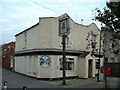
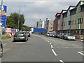
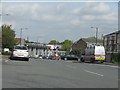
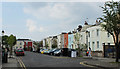
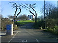
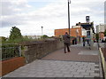
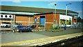
Photos of BS1 1DD

Area Information
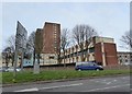
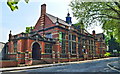
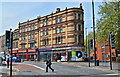
BS1 1DD is a compact residential postcode in east Bristol, encompassing parts of Lawrence Hill, Easton, and Broadmead. With a population of 2535 spread over 2079 m², the area is densely populated, reflecting its role as a historically significant and transport-linked hub. The postcode sits near the A420 and A4320 roads, with the Bristol and Bath Railway Path running through its southern edge. The area’s name traces back to St Lawrence’s Hospital, a medieval leper house founded by King John, and today it blends historic architecture with mid-20th-century tower blocks like Kingsmarsh House. Its proximity to Broadmead’s shopping area and the Temple Meads railway station makes it a key node in Bristol’s transport network. Daily life here is shaped by its mix of retail, transport, and planned urban renewal, with the high street near the train station earmarked for redevelopment into a mixed-use town centre. This makes BS1 1DD a practical choice for those prioritising connectivity and proximity to city amenities.
- Area Type
- Postcode
- Area Size
- 2079 m²
- Population
- 2535
- Population Density
- 6694 people/km²
BS1 1DD’s property market is defined by its 29% home ownership rate, indicating that most residents are renters rather than homeowners. The area is primarily composed of houses, though the presence of mid-20th-century tower blocks such as Kingsmarsh House and Baynton Houses suggests a mix of older and more modern housing stock. This small postcode area, with its limited size, is likely to have a tightly competitive market, particularly given its proximity to transport hubs like Temple Meads station and the planned revitalisation of the high street. For buyers, the focus would be on the existing housing stock, which may offer both traditional homes and more contemporary living options. The area’s compact nature means that properties here are likely to be in high demand, especially for those seeking easy access to Bristol’s central amenities.
House Prices in BS1 1DD
No properties found in this postcode.
Energy Efficiency in BS1 1DD
The lifestyle in BS1 1DD is shaped by its proximity to retail, transport, and community spaces. Nearby shops include Iceland Easton, Lidl Easton, and Sainsburys Bristol, offering everyday essentials. The high street near the train station is targeted for redevelopment, promising future enhancements to local commerce and public spaces. Residents can access multiple rail stations, ferry landings, and the Bristol and Bath Railway Path, which supports walking and cycling. The area’s compact nature means amenities are within practical reach, though the lack of major parks or leisure facilities is notable. The presence of mid-20th-century tower blocks and planned urban renewal suggests a blend of historic and evolving environments. For those prioritising convenience and transport links, BS1 1DD offers a practical lifestyle with a focus on connectivity.
Amenities
Schools
Residents of BS1 1DD have access to several primary schools, including Millpond Primary School, Easton CofE VA Junior School, Easton CofE VA Infant School, Baptist Mills Junior School, and Baptist Mills Infant School. These institutions cater to younger children, with a focus on primary education. The presence of multiple primary schools within the area suggests a strong local network for early education, though the data does not specify Ofsted ratings or academic performance. For families, the availability of several primary schools within walking distance is a key advantage, though secondary education options would require commuting to nearby areas. The concentration of primary schools also indicates a community-oriented approach to education, with schools likely playing a central role in the social fabric of the area.
| Rank | School | Type | Entry gender | Ages |
|---|
Explore more schools in this area
Go to Schools tabDemographics
The population of BS1 1DD has a median age of 47, with the majority of residents aged between 30 and 64. This suggests a community of established professionals and families, though the 29% home ownership rate indicates a significant proportion of residents rent their homes. The area is predominantly composed of houses, though the presence of mid-1960s tower blocks like Kingsmarsh House and Baynton Houses hints at a mix of housing stock. The predominant ethnic group is Black residents, reflecting broader demographic patterns in the region. While the data does not specify deprivation levels, the high population density and mix of housing types suggest a diverse but compact community. The age profile implies a stable, middle-aged demographic, which may influence local services and amenities.
Household Size
Accommodation Type
Tenure
Ethnic Group
Religion
Household Composition
Age
Household Deprivation
NS-SEC
Explore more demographic insights in this area
Go to Demographics tabPlanning
Planning Constraints
- Flood RiskPremium
- Ramsar Wetland SitesPremium
- Area of Outstanding Natural BeautyPremium
- Protected Nature ReservePremium
- Protected WoodlandPremium