Area Overview for Bridford
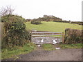
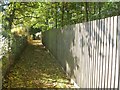
Photos of Bridford
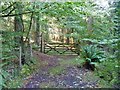
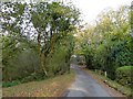
![In Hedgemoor Plantation [3] in Bridford](https://images.propbar.co.uk/images/geograph/59/22/5922865_120.jpg)
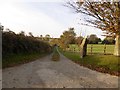
![In Hedgemoor Plantation [4] in Bridford](https://images.propbar.co.uk/images/geograph/59/25/5925230_120.jpg)
Area Information
Living in Bridford offers a distinct experience defined by its status as a small civil parish across England. You will find this parish spans 16.8 km², providing a compact footprint with a quiet, rural character. The area is remarkably settled, characterised by a community where long-term residents have put down deep roots. This stability creates a peaceful environment where daily life moves at a deliberate pace. You will not encounter the rapid turnover of larger urban centres here. Instead, the atmosphere focuses on neighbourly consistency and a strong sense of place. The small size of the parish means that amenities are likely within easy walking distance, though you must plan for travel if you require major shopping or specialist services found in larger towns. The scale of Bridford suggests a lifestyle focused on the immediate surroundings. Many homes face green belts or open spaces, reinforcing the connection between your living space and the natural environment. When considering homes in Bridford, you are choosing a location where the focus remains on local community interaction rather than metropolitan hustle. This suitability appeals to those seeking simplicity and privacy. It is an area where the boundaries are clear, and the pace is set by nature and tradition. You can expect a high degree of privacy because the population density is inherently low across the entire 16.8 km². The demographic reality of the area further supports this quiet lifestyle choice.
- Area Type
- Parish
- Area Size
- 16.8 km²
- Population
- Not available
- Population Density
- Not available
Demographics
The community in Bridford is defined by a notably mature population. The median age stands at 70 years, which is significantly higher than the national average for many parts of England. This statistic indicates that the majority of residents are seniors, many of whom have lived in the area for decades. The population profile suggests a quieter, more settled neighbourhood where daily interactions centre around local shops and community centres rather than night-time activity. Home ownership levels reveal a further layer of stability within this community. A staggering 77% of households in Bridford own their property. This high figure is a strong indicator of economic security and long-term residence rates. It also means that the rental sector is a minor part of the local housing market. For a buyer, this high ownership rate reduces the likelihood of vacant properties changing hands frequently. It suggests a reliable investment landscape where tenants are a minority. The accommodation mix reflects this ownership dominance, with a vast majority of addresses occupied by owners rather than landlords. While specific breakdowns of household composition are not detailed in the raw figures, the ownership statistic tells a clear story of permanence. When you look at schools near Bridford, you are likely catering to a predominantly adult population, with fewer children than in younger suburbs. This demographic reality shapes the local services and the general rhythm of life. You are entering a home in Bridford where stability is the rule rather than the exception.
Household Size
Accommodation Type
Tenure
Ethnic Group
Religion
Household Composition
Age
Household Deprivation
NS-SEC
Explore more demographic insights in this area
Go to Demographics tabPlanning
Planning Constraints
- Flood RiskPremium
- Ramsar Wetland SitesPremium
- Area of Outstanding Natural BeautyPremium
- Protected Nature ReservePremium
- Protected WoodlandPremium