Area Overview for Brentor
Photos of Brentor


Area Information
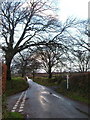
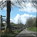
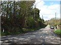
Brentor is a civil parish located in England that spans an area of 13.5 square kilometres. Living in this village offers a rural experience defined by quietness and a strong sense of community. The settlement is compact, meaning daily essential services and neighbours are likely within easy walking distance. You will find that life here moves at a deliberate pace, far removed from the congestion of major towns. This location is suitable for those who prioritise peace over urban convenience. The village represents a traditional corner of the English countryside where modern amenities blend with historic charm. Residents enjoy a slower lifestyle where the primary focus is on community interaction and natural surroundings. There are no large commercial centres within the immediate boundaries, so you will likely need to travel to nearby towns for significant shopping trips. Despite this, the small footprint ensures a close-knit environment. Potential buyers should understand that settling here involves trading accessibility for tranquillity. This is a place where you will know your neighbours by name. The 13.5 km² extent provides enough space for greenery while maintaining a village centre. It is an established community where history is preserved, yet residents adapt to modern living standards. Whether you seek a retirement haven or a quiet family home, Brentor delivers a consistent, rural atmosphere. The distinct lack of urban noise allows you to appreciate the seasons as they change. This parish stands as a stable, enduring option for those wanting a genuine village experience.
- Area Type
- Parish
- Area Size
- 13.5 km²
- Population
- Not available
- Population Density
- Not available
Demographics
The community in Brentor displays a remarkably mature demographic profile. The median age is recorded at 70 years, indicating that the population skews significantly towards older residents. This age structure suggests the area is popular with retirees or those seeking a retirement location. Most common age statistics align with this high median, showing that children and young families form a smaller part of the total count. As a result, you should expect a neighbourhood where social interactions often centre around leisure activities and community events rather than school runs. Home ownership stands at 83%, which is a very high figure for any modern UK settlement. This statistic confirms that the vast majority of households in Brentor own their properties outright. Very few residents rent their homes, creating a stable environment where people put deep roots down. Such high tenure levels often correlate with a slower population turnover, meaning long-standing families are likely to remain in their properties for decades. You will find neighbours who have lived in the village for many years. Accommodation types and household composition reflect this owner-occupied reality. Diverse ethnic and religious groupings are noted in the local records, though the aggregate data focuses on these totals rather than specific breakdowns. The high ownership rate means that vacancy rates are likely low, and properties move less frequently than in cities. For a homebuyer, this implies a competitive market where you will need to prepare a robust offer. The community feel is built on generations of ownership and shared history within these boundaries.
Household Size
Accommodation Type
Tenure
Ethnic Group
Religion
Household Composition
Age
Household Deprivation
NS-SEC
Explore more demographic insights in this area
Go to Demographics tabPlanning
Planning Constraints
- Flood RiskPremium
- Ramsar Wetland SitesPremium
- Area of Outstanding Natural BeautyPremium
- Protected Nature ReservePremium
- Protected WoodlandPremium
- Crime RiskPremium