Area Overview for Braunton
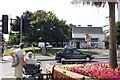
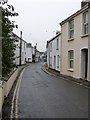
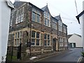
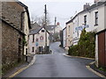
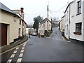
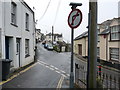
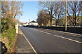
Photos of Braunton


Area Information
Braunton is a compact built-up area in England, covering 2.4 km². It is a place where the older population predominates, with a median age of 70, suggesting a community shaped by long-term residents and a slower pace of change. The area’s small size means amenities and services are closely clustered, making daily life convenient. Residents benefit from proximity to coastal towns like Barnstaple, with nearby ferries to Appledore and Instow offering access to the surrounding countryside. Braunton’s character is defined by its blend of local shops, schools, and transport links, creating a self-contained environment. While the broadband score is modest, mobile coverage is strong, supporting connectivity for both work and leisure. The area’s safety record, with a crime risk score of 85, adds to its appeal as a stable place to live. For those seeking a quiet, established community with practical amenities, Braunton offers a distinct alternative to larger urban centres.
- Area Type
- Built Up Area 250
- Area Size
- 2.4 km²
- Population
- Not available
- Population Density
- Not available
Braunton’s lifestyle is shaped by its proximity to shops, transport, and natural amenities. Local retail options include Co-op Braunton, Tesco Braunton, and Spar Braunton, offering everyday essentials within walking distance. The nearby ferries to Appledore and Instow provide access to scenic coastal routes, while the Barnstaple Railway Station connects to regional hubs. The area’s compact size ensures that amenities are easily reachable, supporting a low-stress lifestyle. Though the data does not detail parks or leisure facilities, the presence of multiple schools and transport links suggests a community focused on practicality and accessibility.
Amenities
Schools
Braunton is served by several primary schools, including Caen Community Primary School, Southmead School, Kingsacre Primary School, and Braunton School and Community College, all of which have either a good Ofsted rating or are listed as primary institutions. The area also includes Braunton Academy, an academy with a good Ofsted rating. This mix of primary schools and an academy provides families with options for different educational approaches, though the absence of secondary school data means further investigation is needed for older children. The consistent good ratings suggest a reliable standard of education, which is a key consideration for families prioritising schools in their decision to move to the area.
| Rank | A + A* % | School | Type | Entry gender | Ages |
|---|---|---|---|---|---|
| 1 | N/A | Caen Community Primary School | primary | N/A | N/A |
| 2 | N/A | Southmead School | primary | N/A | N/A |
| 3 | N/A | Kingsacre Primary School | primary | N/A | N/A |
| 4 | N/A | Braunton School and Community College | primary | N/A | N/A |
| 5 | N/A | Braunton Academy | academy | N/A | N/A |
Explore more schools in this area
Go to Schools tabDemographics
Braunton’s population is predominantly older, with a median age of 70. This reflects a community where long-term residents are more common than younger families. Home ownership is high, at 72%, indicating a strong presence of owner-occupied properties. The data does not specify household composition or accommodation types, but the overall figures suggest a mix of family homes and retirement properties. The area’s demographics do not provide detailed information on ethnic diversity or religious composition, but the high home ownership rate implies a settled, low-turnover population. For those considering Braunton, the age profile and ownership figures suggest a mature, stable environment, though it may not cater to those seeking a rapidly growing or younger demographic.
Household Size
Accommodation Type
Tenure
Ethnic Group
Religion
Household Composition
Age
Household Deprivation
NS-SEC
Explore more demographic insights in this area
Go to Demographics tabPlanning
Planning Constraints
- Crime RiskLocked