Area Overview for Branscombe
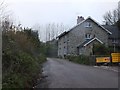
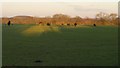
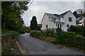
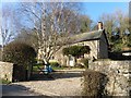
Photos of Branscombe


Area Information
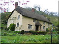
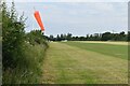
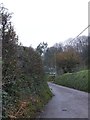
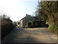
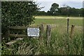
Living in Branscombe means settling into a civil parish that covers 14.1 square kilometres along the Devon coast. You are stepping into a location defined by rural charm and coastal access rather than urban pace. The area stands out for its quiet nature and proximity to the sea, offering a lifestyle far removed from city congestion. This parish provides a compact living environment where every journey is local and direct. Prospective buyers appreciate the distinct separation from larger towns, yet you remain connected to the wider region through existing transport links. The geography dictates a slower rhythm of life, ideal for those seeking peace over proximity to commercial hubs. Your daily routine revolve around local amenities and the natural landscape surrounding you. This is a place where the定义 of community relies on local knowledge and neighbourly interaction rather than high-density urban infrastructure. When you consider homes in Branscombe, you are investing in a setting that prioritises environmental beauty and low population density. The scale of the parish ensures that each home occupies a significant amount of land, granting you access to open spaces. Real estate here is driven by its location and character rather than by statutory planning constraints typical of crowded metropolitan zones.
- Area Type
- Parish
- Area Size
- 14.1 km²
- Population
- Not available
- Population Density
- Not available
Demographics
The community within Branscombe is defined by an older demographic profile that significantly influences local life. The median age for residents is 70 years, indicating a population skewed towards retirees and olderLong-term residents. You will find that the typical household consists of people in this age bracket, shaping the demand for local services and housing types. Home ownership is the dominant model, with 68% of residents owning their properties outright or with a mortgage. This high level of ownership suggests a stable community where families stay settled rather than moving frequently due to rental cycles. The social fabric reflects a preference for permanent residence over transient living arrangements. Data on household composition and accommodation types confirms that the majority of dwellings cater to long-term needs rather than temporary occupancy. There are no significant younger cohorts driving a rental market in this specific parish. Consequently, the area functions as a retirement destination or a hub for semi-retired professionals seeking a quiet life. The ethnic and religious diversity data is available in official records but does not significantly alter the general profile of a traditionally homogeneous English coastal village. Your neighbourhood will reflect these stable, owner-occupied dynamics where residents have likely lived in their homes for decades.
Household Size
Accommodation Type
Tenure
Ethnic Group
Religion
Household Composition
Age
Household Deprivation
NS-SEC
Explore more demographic insights in this area
Go to Demographics tabPlanning
Planning Constraints
- Flood RiskPremium
- Ramsar Wetland SitesPremium
- Area of Outstanding Natural BeautyPremium
- Protected Nature ReservePremium
- Protected WoodlandPremium
- Crime RiskPremium