Area Overview for Blunsdon
Photos of Blunsdon

Area Information
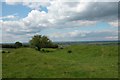
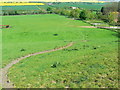
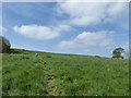
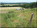
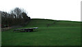
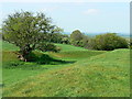
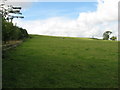
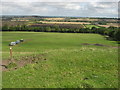
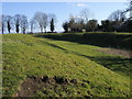
Living in Blunsdon means residing in a civil parish characterised by its rural setting and historic roots. This area covers 10 square kilometres and sits within the Borough of Swindon in Wiltshire. You will find yourself approximately 4 miles north of Swindon town centre, situated on elevated land that overlooks the Upper Thames valley. The parish comprises three distinct settlements: Broad Blunsdon, Lower Blunsdon, and the former hamlet of Broadbush. Your daily life is anchored by the A419 road, which runs along the southern boundary of the parish. This route follows the path of Ermin Street, a Roman road linking Gloucester to Silchester. While Swindon's expansion brings newer properties to the south, Blunsdon retains a village feel with open countryside to the north and historic buildings. The Cotswolds lie to your north, providing a scenic backdrop to the heavily wooded Blunsdon Forest. Your horizon is defined by the A419 and the rolling landscape rather than a dense urban sprawl. This location offers a balance between the tranquillity of a Devonshire-like village and proximity to a larger town. If you are seeking homes in Blunsdon, expect a community defined by its elevation, history, and separation from the immediate rush of the city below. You stand on land watched briefly by birds but visited regularly by the A419 traffic.
- Area Type
- Parish
- Area Size
- 10.0 km²
- Population
- Not available
- Population Density
- Not available
Demographics
The human community within Blunsdon presents a distinctly settled profile. The median age across the parish is 70 years old, indicating a population with a strong senior presence. You are likely to interact mainly with retirees or long-term residents rather than young families forming households. The vast majority of people living in Blunsdon own their properties outright, with a record showing 77% of the population own their homes. This high level of ownership suggests deep-rooted community ties and stability. Because most people own their homes, rental availability is likely very low compared to other market areas. The diversity of the area, in terms of ethnic breakdown and religious affiliation, is not detailed in the available records, so you cannot form specific conclusions on those fronts. Instead, the demographic reality is one of a mature, owner-occupied settlement. Those living in Blunsdon have likely put down permanent roots decades ago. You will not find the transient feel of a student town or the rapid turnover of a city rental zone. The community composition is stable, focused on older age groups who have chosen to remain in this specific civil parish. Your neighbours are probably those who have shared the village for many years.
Household Size
Accommodation Type
Tenure
Ethnic Group
Religion
Household Composition
Age
Household Deprivation
NS-SEC
Explore more demographic insights in this area
Go to Demographics tabPlanning
Planning Constraints
- Flood RiskPremium
- Ramsar Wetland SitesPremium
- Area of Outstanding Natural BeautyPremium
- Protected Nature ReservePremium
- Protected WoodlandPremium
- Crime RiskPremium