Area Overview for Bishopston & Ashley Down Ward
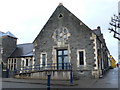
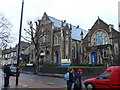
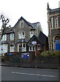
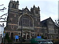
Photos of Bishopston & Ashley Down Ward
Area Information
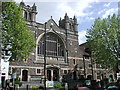
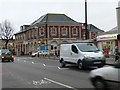
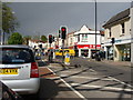
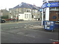
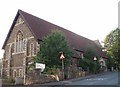
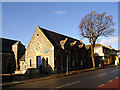
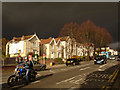
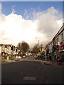
Bishopston & Ashley Down Ward sits on the high ground of northern Bristol, forming a distinct residential neighbourhood within the city. This electoral ward covers an area of just 1.5 km² and serves a population of 1,892 residents. The location lies east of the central areas, specifically around the postcodes in the BS7 region. The ward was formally established in May 2016 following a boundary review that merged the former Bishopston ward to include parts of Ashley Down and Horfield. Living in this area offers proximity to significant local landmarks such as Gloucester Road and the Bristol County Ground. Resting near Cardinal Newman Park, the ward benefits from its urban positioning without being tucked into the dense city centre core. Ashley Down Road acts as the primary thoroughfare, linking the neighbourhood to wider Bristol. The site of the former Ashley Hill railway station now hosts the new Ashley Down railway station, which opened in September 2024. This modern transport hub provides hourly Great Western Railway services to Bristol Temple Meads and Filton Abbey Wood. The history here is deep, with George Müller establishing his renowned orphanage in 1864 on land that influenced the area's character for generations. Today, the ward feels like a focused community hub rather than a sprawling suburb. It remains a practical choice for those seeking a Norwich-style stop in the north-east of the city, blending historical weight with modern infrastructure.
- Area Type
- District Borough Unitary Ward
- Area Size
- 1.5 km²
- Population
- 1892
- Population Density
- 1235 people/km²
Demographics
The community within Bishopston & Ashley Down Ward displays a clear demographic split. The median age of residents is exactly 70 years, marking a district with a mature population profile. Despite this, the ward is not exclusively for seniors, as over 18 per cent of the population is aged between 16 and 24, and nearly 30 per cent falls into the 25 to 39 age bracket. When you look at household composition in the ward, the average household size is 2.3 people per home. Homeownership is a dominant feature of local life, with 66 per cent of the population owning their properties outright or with a mortgage. This high rate of ownership suggests stability and a strong community investment. The ward contains 745 households in total, reflecting the density of the 1,892 residents across its 1.5 km² footprint. Population density stands at 1,235 people per km², which is slightly lower than the average for Bristol. Diversity and accommodation types are managed within the ward's small footprint. While specific ethnic and religious breakdowns are not detailed in the primary dataset, the mix of young professionals and older residents creates a layered demographic environment. The presence of both young adults and retirees indicates a neighbourhood that supports different life stages simultaneously. This balance is evident in the housing stock, which ranges from older terraced homes to more modern conversions.
Household Size
Accommodation Type
Tenure
Ethnic Group
Religion
Household Composition
Age
Household Deprivation
NS-SEC
Explore more demographic insights in this area
Go to Demographics tabPlanning
Planning Constraints
- Flood RiskPremium
- Ramsar Wetland SitesPremium
- Area of Outstanding Natural BeautyPremium
- Protected Nature ReservePremium
- Protected WoodlandPremium