Area Overview for Birdlip
Photos of Birdlip

Area Information
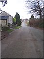
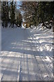
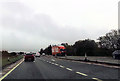
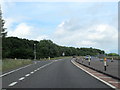
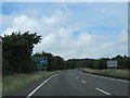
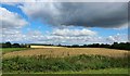
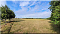
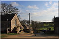
Birdlip is a small civil parish located in England, covering a distinct footprint of 4.3 km². The area functions as a tranquil locality rather than a bustling town, offering a specific kind of rural living that appeals to those seeking space over urban density. Residents here experience daily life characterised by relative quiet and close ties to the natural surroundings defined by the parish boundaries. The setting is compact, meaning that local amenities and the wider countryside are often within easy reach for anyone living in Birdlip. This neighbourhood presents itself as a settled community where the pace of life remains consistent with its modest size. Potential buyers should view Birdlip as a place where proximity to nature defines the quality of everyday living. The area does not boast large commercial districts but instead relies on the character of its residential zones. A homebuyer looking for a defined boundary and a contained environment will find Birdlip fits that criteria perfectly. The limited land area means that the community remains intimate, with each property overlooking similar neighbours and shared landscapes.
- Area Type
- Parish
- Area Size
- 4.3 km²
- Population
- Not available
- Population Density
- Not available
Demographics
The community within Birdlip has a distinct demographic profile shaped by its rural location and limited population size. The most telling statistic is the median age, which stands at 70. This figure confirms that the majority of residents are senior citizens rather than families with young children or young professionals moving for work. Over three quarters of households, specifically 73 per cent, are owner-occupied. This high ownership rate indicates that many people here have permanent roots and have lived in their homes for extended periods. The remaining 27 per cent of households rely on other forms of tenure, suggesting a smaller cohort of long-term tenants or younger buyers entering the market. While the data does not provide a breakdown of household composition types, the age median strongly implies that single-person households or couples with no dependent children form the core of the area. As for ethnic diversity and religious affiliation, the provided records do not specify the predominant group or religious makeup. However, the demographic snapshot confirms that Birdlip is not a young, transient hub but a mature settlement where ownership stability is the norm.
Household Size
Accommodation Type
Tenure
Ethnic Group
Religion
Household Composition
Age
Household Deprivation
NS-SEC
Explore more demographic insights in this area
Go to Demographics tabPlanning
Planning Constraints
- Flood RiskPremium
- Ramsar Wetland SitesPremium
- Area of Outstanding Natural BeautyPremium
- Protected Nature ReservePremium
- Protected WoodlandPremium
- Crime RiskPremium