Area Overview for BH9 3LY
Photos of BH9 3LY
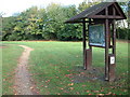
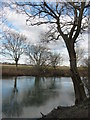
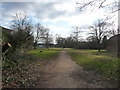
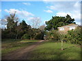

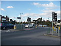
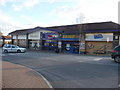
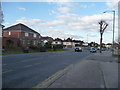
100 photos from this area
Area Information
Key information about the BH9 3LY including its size, population, and administrative classification.
- Area Type
- Postcode
- Area Size
- 1.2 hectares
- Population
- Not available
- Population Density
- Not available
House Prices in BH9 3LY
27
Properties
£294,375
Average Sold Price
£60,000
Lowest Price
£510,000
Highest Price
Showing 27 properties
| Address | Type | Beds | Baths | Last Sale Price | Last Sale Date | |
|---|---|---|---|---|---|---|
| 9 Cox Avenue, Bournemouth, BH9 3LY | house | - | - | £345,000 | May 2024 | |
| 10 Cox Avenue, Bournemouth, BH9 3LY | Detached | 3 | 2 | £510,000 | Mar 2024 | |
| 16 Cox Avenue, Bournemouth, BH9 3LY | Detached | 3 | 1 | £495,000 | Nov 2023 | |
| 20 Cox Avenue, Bournemouth, BH9 3LY | Retail | 2 | 1 | £425,000 | Jul 2022 | |
| 27 Cox Avenue, Bournemouth, BH9 3LY | house | - | - | £389,000 | Jan 2021 | |
| 18 Cox Avenue, Bournemouth, BH9 3LY | Detached | 3 | 1 | £380,000 | Feb 2018 | |
| 32 Cox Avenue, Bournemouth, BH9 3LY | Bungalow | 3 | 1 | £345,000 | Nov 2015 | |
| 21 Cox Avenue, Bournemouth, BH9 3LY | Detached | 3 | - | £348,000 | Sep 2014 | |
| 23 Cox Avenue, Bournemouth, BH9 3LY | house | - | - | £236,000 | Oct 2012 | |
| 28 Cox Avenue, Bournemouth, BH9 3LY | Detached | 4 | 2 | £270,000 | Apr 2007 |
Page 1 of 3
Energy Efficiency in BH9 3LY
Amenities
Schools
| Rank | School | Type | Entry gender | Ages |
|---|
Explore more schools in this area
Go to Schools tabDemographics
Household Size
Family (3-5 people)
most common
Accommodation Type
Houses
most common
Tenure
89
majority
Ethnic Group
White
most common
Religion
N/A
most common
Household Composition
N/A
most common
Age
47
median
Adults (30-64 years)
most common
Household Deprivation
N/A
with no deprivation
NS-SEC
33
in Lower managerial occupations
Explore more demographic insights in this area
Go to Demographics tabPlanning
Planning Constraints
- Flood RiskPremium
- Ramsar Wetland SitesPremium
- Area of Outstanding Natural BeautyPremium
- Protected Nature ReservePremium
- Protected WoodlandPremium