Area Overview for BH9 3LT
Photos of BH9 3LT
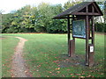
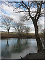
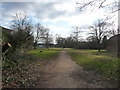
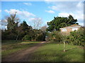


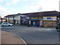
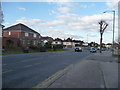
100 photos from this area
Area Information
Key information about the BH9 3LT including its size, population, and administrative classification.
- Area Type
- Postcode
- Area Size
- 1.4 hectares
- Population
- 1481
- Population Density
- 4160 people/km²
House Prices in BH9 3LT
35
Properties
£208,809
Average Sold Price
£59,000
Lowest Price
£340,000
Highest Price
Showing 35 properties
| Address | Type | Beds | Baths | Last Sale Price | Last Sale Date | |
|---|---|---|---|---|---|---|
| 26 Cox Close, Bournemouth, BH9 3LT | Terraced | 3 | 1 | £325,000 | Apr 2023 | |
| 44 Cox Close, Bournemouth, BH9 3LT | Retail | 3 | 1 | £340,000 | Nov 2022 | |
| 19 Cox Close, Bournemouth, BH9 3LT | house | - | - | £311,000 | Sep 2021 | |
| 17 Cox Close, Bournemouth, BH9 3LT | Terraced | 3 | 1 | £307,000 | Apr 2021 | |
| 48 Cox Close, Bournemouth, BH9 3LT | Semi-detached | 3 | 2 | £335,000 | Mar 2021 | |
| 10 Cox Close, Bournemouth, BH9 3LT | Semi-detached | 3 | 1 | £310,000 | Mar 2021 | |
| 8 Cox Close, Bournemouth, BH9 3LT | Semi-detached | 4 | 1 | £325,000 | Nov 2018 | |
| 42 Cox Close, Bournemouth, BH9 3LT | Terraced | 3 | 1 | £274,950 | Nov 2016 | |
| 30 Cox Close, Bournemouth, BH9 3LT | house | - | - | £265,000 | Mar 2016 | |
| 34 Cox Close, Bournemouth, BH9 3LT | Semi-detached | 3 | - | £243,000 | Nov 2015 |
Page 1 of 4
Energy Efficiency in BH9 3LT
Amenities
Schools
| Rank | School | Type | Entry gender | Ages |
|---|
Explore more schools in this area
Go to Schools tabDemographics
Household Size
Family (3-5 people)
most common
Accommodation Type
Houses
most common
Tenure
77
majority
Ethnic Group
White
most common
Religion
N/A
most common
Household Composition
N/A
most common
Age
47
median
Adults (30-64 years)
most common
Household Deprivation
N/A
with no deprivation
NS-SEC
38
in Lower managerial occupations
Explore more demographic insights in this area
Go to Demographics tabPlanning
Planning Constraints
- Flood RiskPremium
- Ramsar Wetland SitesPremium
- Area of Outstanding Natural BeautyPremium
- Protected Nature ReservePremium
- Protected WoodlandPremium