Area Overview for BH9 3EW
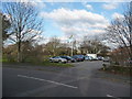
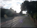
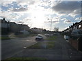
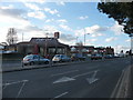
Photos of BH9 3EW

Area Information
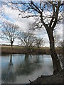
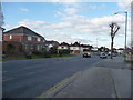
BH9 3EW lies in the eastern suburbs of Bournemouth, within the Muscliff and Strouden Park electoral ward. This small postcode area, home to around 1,481 residents, sits near the River Stour valley, blending historical heathland with 19th-century suburban development. The area’s roots trace back to pre-1805 enclosures that transformed open land into fields and roads, shaping the character of Muscliff Road and surrounding villages. Today, BH9 3EW is a quiet residential cluster with a focus on family living, reflected in its median age of 47 and strong home ownership rate. Residents benefit from proximity to Bournemouth’s amenities, including multiple rail stations, airports, and ferry services, while retaining a sense of local identity. The area’s compact size means daily life is walkable, with shops, schools, and green spaces within easy reach. For those seeking a balanced lifestyle, BH9 3EW offers a mix of historic charm and modern convenience, ideal for families or professionals looking for a stable, low-crime environment.
- Area Type
- Postcode
- Area Size
- Not available
- Population
- 1481
- Population Density
- 4160 people/km²
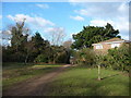
BH9 3EW is a predominantly owner-occupied area, with 77% of homes owned by residents rather than rented. The housing stock is largely composed of houses, reflecting a suburban character that prioritises private living spaces over apartments or flats. This suggests a community of established homeowners, many of whom may have lived in the area for years. The small size of the postcode means the housing market is limited, with fewer properties available compared to larger urban areas. Buyers should consider the proximity to Bournemouth’s wider suburbs, where additional options may exist. The focus on houses indicates a demand for family-friendly homes with gardens, which aligns with the area’s demographic of adults aged 30–64. For those seeking a low-maintenance, stable investment, BH9 3EW’s property market offers a reliable, if modest, opportunity.
House Prices in BH9 3EW
No properties found in this postcode.
Energy Efficiency in BH9 3EW
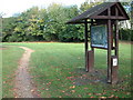
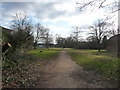
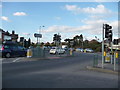
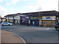
Living in BH9 3EW offers access to a range of amenities that cater to daily needs and leisure. Retail options include Tesco Muscliffe, Asda Westway, and The Southern Co-operative, ensuring groceries and essentials are within walking or short driving distance. The area’s proximity to Bournemouth’s airports and ferry services adds to its convenience, particularly for those who travel frequently. For commuters, rail stations like Bournemouth and Branksome provide links to regional hubs. The nearby Strouden Woods and historical sites such as Muscliff Farm add green space and a touch of local heritage. Residents can enjoy a mix of practicality and accessibility, with shops, transport, and natural spaces all within reach. This balance supports a lifestyle that is both functional and enjoyable.
Amenities
Schools
Residents of BH9 3EW have access to two notable schools. The Epiphany Church of England Primary School provides early education, while The Epiphany School, an academy rated ‘good’ by Ofsted, offers secondary education. The presence of both a primary school and an academy suggests a well-rounded educational environment, catering to children from early years through to adolescence. The Epiphany School’s ‘good’ rating indicates a standard of teaching and facilities that meet national benchmarks, which is reassuring for families prioritising quality education. The proximity of these schools to the area means parents can avoid long commutes, reinforcing BH9 3EW’s appeal as a family-friendly location. The mix of school types also allows for choice, whether families prefer a faith-based primary school or a state-funded academy.
| Rank | School | Type | Entry gender | Ages |
|---|
Explore more schools in this area
Go to Schools tabDemographics
The population of BH9 3EW is predominantly adults aged 30–64, with a median age of 47. This suggests a mature, established community, likely with long-term residents and families. Home ownership is high at 77%, indicating a stable housing market with fewer renters. The area is primarily composed of houses, reflecting a traditional suburban layout. The predominant ethnic group is White, though no specific data on diversity or deprivation is provided. The age profile and ownership statistics point to a community focused on long-term living, with fewer transient populations. This stability may contribute to a cohesive local environment, where residents are likely to know their neighbours and engage in community activities. The absence of specific data on deprivation means the quality of life here is inferred from the low crime rate and access to amenities.
Household Size
Accommodation Type
Tenure
Ethnic Group
Religion
Household Composition
Age
Household Deprivation
NS-SEC
Explore more demographic insights in this area
Go to Demographics tabPlanning
Planning Constraints
- Flood RiskPremium
- Ramsar Wetland SitesPremium
- Area of Outstanding Natural BeautyPremium
- Protected Nature ReservePremium
- Protected WoodlandPremium