Area Overview for BH9 3DX
Photos of BH9 3DX
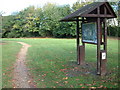
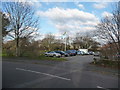
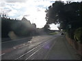

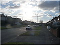
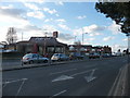
100 photos from this area
Area Information
Key information about the BH9 3DX including its size, population, and administrative classification.
- Area Type
- Postcode
- Area Size
- 1.3 hectares
- Population
- Not available
- Population Density
- Not available
House Prices in BH9 3DX
18
Properties
£414,933
Average Sold Price
£77,000
Lowest Price
£895,000
Highest Price
Showing 18 properties
| Address | Type | Beds | Baths | Last Sale Price | Last Sale Date | |
|---|---|---|---|---|---|---|
| 129 West Way, Bournemouth, BH9 3DX | Detached | 3 | 1 | £540,000 | Sep 2025 | |
| 149 West Way, Bournemouth, BH9 3DX | Detached | 5 | 3 | £895,000 | Sep 2024 | |
| 137 West Way, Bournemouth, BH9 3DX | house | - | - | £555,555 | Apr 2021 | |
| 133 West Way, Bournemouth, BH9 3DX | Detached | 4 | - | £540,000 | Mar 2021 | |
| 127 West Way, Bournemouth, BH9 3DX | Detached | 4 | 2 | £450,000 | May 2020 | |
| 143 West Way, Bournemouth, BH9 3DX | Detached | 3 | 1 | £435,000 | Aug 2018 | |
| 147 West Way, Bournemouth, BH9 3DX | Detached | 3 | 2 | £435,000 | Apr 2018 | |
| 135 West Way, Bournemouth, BH9 3DX | Detached | 5 | 4 | £442,500 | Mar 2018 | |
| 139 West Way, Bournemouth, BH9 3DX | Detached | 6 | - | £447,500 | Dec 2015 | |
| 153 West Way, Bournemouth, BH9 3DX | Detached | 5 | - | £371,000 | Nov 2013 |
Page 1 of 2
Energy Efficiency in BH9 3DX
Amenities
Schools
| Rank | School | Type | Entry gender | Ages |
|---|
Explore more schools in this area
Go to Schools tabDemographics
Household Size
Family (3-5 people)
most common
Accommodation Type
Houses
most common
Tenure
81
majority
Ethnic Group
White
most common
Religion
N/A
most common
Household Composition
N/A
most common
Age
47
median
Adults (30-64 years)
most common
Household Deprivation
N/A
with no deprivation
NS-SEC
37
in Lower managerial occupations
Explore more demographic insights in this area
Go to Demographics tabPlanning
Planning Constraints
- Flood RiskPremium
- Ramsar Wetland SitesPremium
- Area of Outstanding Natural BeautyPremium
- Protected Nature ReservePremium
- Protected WoodlandPremium