Area Overview for BH9 2ZD
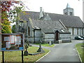
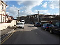
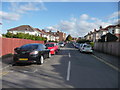
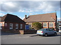
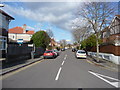
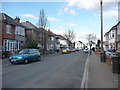
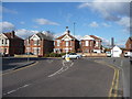
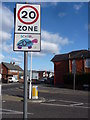
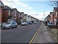
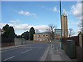
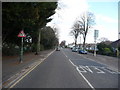
Photos of BH9 2ZD

Area Information
BH9 2ZD is a small residential postcode in the Bournemouth area of Dorset, England, encompassing parts of Wallisdown and West Winton. With a population of 1,805, it reflects a compact, community-focused cluster of homes. The area’s origins trace back to 19th-century heathland enclosures, shaped by historical tracks like Wallisdown Road, which once connected Poole to Bournemouth. Today, it is part of the Bournemouth, Christchurch and Poole unitary authority, with a median age of 47 and a predominantly adult population (30–64 years). Life here is defined by proximity to local amenities, including primary schools, rail networks, and coastal access. The area’s residential character is underscored by a high home ownership rate (70%) and a focus on houses rather than flats. While small in scale, BH9 2ZD offers a blend of historical context and practical modern living, with easy access to nearby towns and transport links. Its quiet, established nature makes it appealing for those seeking a stable, family-oriented environment without the density of larger urban areas.
- Area Type
- Postcode
- Area Size
- Not available
- Population
- Not available
- Population Density
- Not available
The property market in BH9 2ZD is characterised by a high home ownership rate (70%) and a predominance of houses over flats. This suggests a community of established homeowners rather than a rental-heavy market. The focus on houses implies larger properties with gardens, typical of suburban or semi-rural settings. Given the small size of the postcode area, the housing stock is likely limited, meaning buyers may need to consider nearby zones for more options. The high home ownership rate also indicates stability, with fewer turnover rates and potential for long-term investment. For buyers, this means properties here are likely to be family homes, offering space and privacy. However, the small size of BH9 2ZD may limit availability, requiring a broader search within the surrounding Bournemouth area.
House Prices in BH9 2ZD
No properties found in this postcode.
Energy Efficiency in BH9 2ZD
Residents of BH9 2ZD enjoy a range of amenities within practical reach. Retail options include major stores like Tesco Moordown, Sainsburys Winton, and Iceland Winton, ensuring access to groceries and daily essentials. Rail stations provide connectivity to Bournemouth and surrounding areas, while Bournemouth Airport and Bournemouth International Airport offer travel flexibility. Ferry landings at Tuckton Tea Gardens and Christchurch Quay provide access to coastal routes and leisure activities. The area’s historical roots are complemented by modern convenience, with a mix of retail, transport, and scenic options. The presence of multiple schools, combined with nearby shops and transport links, supports a balanced lifestyle. For families, the proximity to primary schools and retail hubs creates a self-contained environment, while the ferry and rail networks offer opportunities for exploration beyond the immediate area.
Amenities
Schools
Residents of BH9 2ZD have access to multiple primary schools, including Winton Primary School, Moordown St John’s Church of England Primary School, and Winton County Junior School. These institutions are listed more than once in the data, suggesting redundancy or proximity to multiple schools within the area. All are primary schools, indicating they cater to younger children, though no Ofsted ratings are provided. The presence of multiple primary schools may offer families choice in education, though the lack of secondary schools nearby could necessitate travel for older students. The repetition of school names may reflect their proximity to different parts of the postcode or administrative duplication. For families, this suggests a focus on early education, with potential for local schooling for younger children.
| Rank | School | Type | Entry gender | Ages |
|---|
Explore more schools in this area
Go to Schools tabDemographics
The population of BH9 2ZD is 1,805, with a median age of 47. The most common age group is adults aged 30–64, indicating a mature, settled community. Home ownership is high at 70%, suggesting a strong presence of long-term residents. The area is predominantly occupied by houses, reflecting a traditional residential layout rather than high-rise or apartment blocks. The predominant ethnic group is White, though specific data on diversity or deprivation is not provided. The age profile implies a community focused on family life and stability, with fewer young children or retirees compared to other areas. This demographic structure may influence local services, such as schools and healthcare, which cater to adult needs. The absence of specific data on deprivation or income levels means the area’s quality of life can only be inferred from its infrastructure and amenities.
Household Size
Accommodation Type
Tenure
Ethnic Group
Religion
Household Composition
Age
Household Deprivation
NS-SEC
Explore more demographic insights in this area
Go to Demographics tabPlanning
Planning Constraints
- Flood RiskPremium
- Ramsar Wetland SitesPremium
- Area of Outstanding Natural BeautyPremium
- Protected Nature ReservePremium
- Protected WoodlandPremium