Area Overview for BH9 2WE
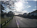
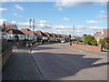
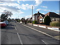
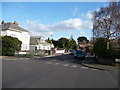
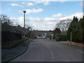
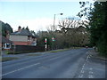
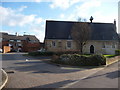
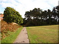
Photos of BH9 2WE


Area Information
Living in BH9 2WE means being part of a small, tightly knit residential cluster in Bournemouth, a town known for its coastal charm and suburban tranquillity. With a population of 1,676, this area balances proximity to urban amenities with a sense of community. Historically rooted, Moordown—where BH9 2WE is located—has Bronze Age origins and 19th-century development, including the relocation of St John’s Church in 1874. The area is bordered by Winton and Charminster, with Wimborne Road serving as a key thoroughfare. Daily life here is shaped by its suburban layout, with a focus on family homes and low-density living. Residents benefit from easy access to Bournemouth’s cultural and commercial hubs, while the area’s compact size fosters a close-knit environment. The presence of nearby rail stations, ferry landings, and retail outlets ensures practical connectivity without the congestion of larger cities. For those seeking a blend of historical character and modern convenience, BH9 2WE offers a distinct slice of South West England’s residential landscape.
- Area Type
- Postcode
- Area Size
- Not available
- Population
- Not available
- Population Density
- Not available
The property market in BH9 2WE is characterised by high home ownership (83%) and a focus on houses, which dominate the housing stock. This suggests a market skewed towards owner-occupiers rather than renters, reflecting a preference for family homes and long-term investment. The prevalence of houses indicates a suburban, low-density environment, which may appeal to those seeking space and privacy. Given the area’s small size and specific postcode, the immediate surroundings likely offer similar housing typologies, reinforcing a cohesive local market. Buyers should note that the area is not a hotbed for rental properties, which may limit opportunities for those seeking to let out properties. However, the high ownership rate implies stable property values and a community invested in local development. For those considering purchase, the emphasis on houses aligns with a lifestyle prioritising permanence and family-friendly living.
House Prices in BH9 2WE
No properties found in this postcode.
Energy Efficiency in BH9 2WE
Residents of BH9 2WE have access to a range of amenities within practical reach, enhancing daily life. The area’s retail offerings include major chains like Co-op Moordown, Tesco Moordown, and Asda Westway, ensuring grocery and household needs are met locally. For transport, five rail stations—including Bournemouth and Branksome—provide direct links to the town centre and beyond, while ferry landings at Tuckton Tea Gardens and Christchurch Quay offer scenic travel options. The proximity to Bournemouth International Airport and Bournemouth Airport adds convenience for regional and national travel. The area’s historical character is complemented by modern facilities, creating a balanced lifestyle. Whether shopping, commuting, or exploring, residents benefit from a mix of practicality and accessibility, with the area’s compact size ensuring amenities are never far away.
Amenities
Schools
| Rank | School | Type | Entry gender | Ages |
|---|
Explore more schools in this area
Go to Schools tabDemographics
The community in BH9 2WE is predominantly composed of adults aged 30–64, with a median age of 47. This suggests a stable population with strong family structures, likely reflecting the area’s focus on owner-occupied homes. Home ownership here is high, at 83%, indicating a preference for long-term residency over rental properties. The accommodation type is primarily houses, which aligns with the suburban character of the area. The predominant ethnic group is White, though specific data on diversity is not provided. The age profile and ownership figures imply a mature, established community with fewer young families or transient populations. This demographic profile may influence local services and amenities, which are tailored to the needs of middle-aged residents. The absence of detailed deprivation data means the area’s quality of life is inferred from its safety, connectivity, and infrastructure, all of which appear favourable.
Household Size
Accommodation Type
Tenure
Ethnic Group
Religion
Household Composition
Age
Household Deprivation
NS-SEC
Explore more demographic insights in this area
Go to Demographics tabPlanning
Planning Constraints
- Flood RiskPremium
- Ramsar Wetland SitesPremium
- Area of Outstanding Natural BeautyPremium
- Protected Nature ReservePremium
- Protected WoodlandPremium