Area Overview for BH9 2DN
Photos of BH9 2DN


Area Information
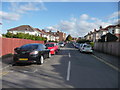
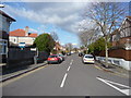
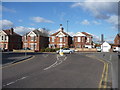
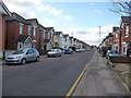
Living in BH9 2DN, a small residential cluster in Bournemouth, Christchurch and Poole, offers a quiet suburban lifestyle with historical roots. The area’s population of 1,717 reflects a mature community, with a median age of 47 and a majority of residents aged 30–64. Nestled north of central Bournemouth, BH9 2DN is bordered by Winton and Charminster, with historical boundaries defined by roads like Wimborne Road. Daily life here is shaped by its proximity to retail, transport, and green spaces. The area’s 20th-century development, including the Mayfield Park Estate and art deco buildings, blends practicality with architectural charm. Residents benefit from nearby amenities such as Co-op and Tesco stores, multiple railway stations, and ferry landings, ensuring ease of access to Bournemouth’s town centre and beyond. While small, the area’s connectivity to major routes like the A338 and proximity to Bournemouth Airport make it a practical choice for commuters and families seeking a balance between tranquillity and accessibility.
- Area Type
- Postcode
- Area Size
- Not available
- Population
- Not available
- Population Density
- Not available
The property market in BH9 2DN is dominated by owner-occupied homes, with 66% of properties owned by residents rather than rented. This suggests a community of long-term residents who have invested in their homes, which may influence the character of the housing stock. The area’s accommodation type is predominantly houses, reflecting a preference for larger, private living spaces over flats. This makes BH9 2DN a niche market, particularly for buyers seeking traditional family homes with garden space. Given the area’s small size, the housing stock is likely limited, meaning properties may be in high demand from those prioritising stability and proximity to amenities. Buyers should consider the potential for limited rental options and the importance of location-specific factors, such as proximity to transport links and local schools, when evaluating properties in this small postcode area.
House Prices in BH9 2DN
Showing 1 properties
| Address | Type | Beds | Baths | Last Sale Price | Last Sale Date | |
|---|---|---|---|---|---|---|
| Stephen Penny & Partners, 902 Wimborne Road, Bournemouth, BH9 2DN | office_workshop | - | - | - | - |
Energy Efficiency in BH9 2DN
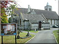
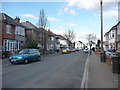
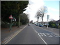
Residents of BH9 2DN have access to a range of amenities within practical reach. The area is served by five retail outlets, including Co-op Moordown and Tesco Moordown, offering everyday shopping needs. For transport, five railway stations—Bournemouth, Branksome, and Pokesdown—provide frequent services to Bournemouth town centre and beyond. Two airports, Bournemouth and Bournemouth International, are within reach, catering to travel needs. Five ferry landings, including Tuckton Tea Gardens and Wick Christchurch, offer scenic routes to nearby coastal towns. These amenities contribute to a convenient lifestyle, blending practicality with access to both urban and natural environments. The presence of historical sites like St John’s Church and the art deco Mayfield Park Buildings adds cultural depth, while the area’s proximity to green spaces and transport links ensures a balanced mix of relaxation and connectivity.
Amenities
Schools
| Rank | School | Type | Entry gender | Ages |
|---|
Explore more schools in this area
Go to Schools tabDemographics
The community in BH9 2DN is predominantly composed of adults aged 30–64, with a median age of 47. Home ownership is high, at 66%, reflecting a stable, long-term resident base. The area is characterised by houses rather than flats, aligning with the preferences of its older demographic. The predominant ethnic group is White, which shapes the cultural and social dynamics of the neighbourhood. This age profile suggests a population focused on family life, retirement, or established careers, with fewer young families compared to other areas. The high home ownership rate indicates a lower reliance on rental properties, which may influence local services and amenities. While specific data on deprivation is absent, the area’s low crime risk and access to essential services suggest a quality of life that supports both stability and practicality for its residents.
Household Size
Accommodation Type
Tenure
Ethnic Group
Religion
Household Composition
Age
Household Deprivation
NS-SEC
Explore more demographic insights in this area
Go to Demographics tabPlanning
Planning Constraints
- Flood RiskPremium
- Ramsar Wetland SitesPremium
- Area of Outstanding Natural BeautyPremium
- Protected Nature ReservePremium
- Protected WoodlandPremium