Area Overview for BH9 2BW
Photos of BH9 2BW
Area Information
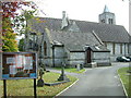
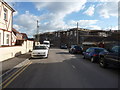
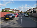
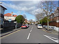
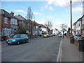
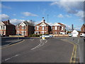
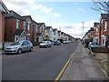
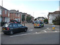
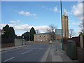
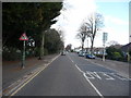
Living in BH9 2BW means being part of a small, tightly knit residential cluster in Bournemouth, nestled north of the town centre. With a population of just 1,717, this area offers a quiet, suburban lifestyle with easy access to the broader Bournemouth and Christchurch regions. The postcode covers a historically significant patch of land, once part of the Manor of Christchurch and shaped by 19th-century developments like the Mayfield Park Estate and Grand Parade. Daily life here balances proximity to modern conveniences with a sense of local heritage. Residents benefit from nearby rail links, including Bournemouth and Pokesdown stations, and are within reach of Bournemouth International Airport. The area’s character is defined by its mix of historic landmarks, such as St John’s Church, and practical amenities like Co-op Moordown and Asda Westway. It’s a place where older adults and families coexist, with a strong emphasis on home ownership and a community feel that reflects its modest scale.
- Area Type
- Postcode
- Area Size
- Not available
- Population
- Not available
- Population Density
- Not available
The property market in BH9 2BW is dominated by owner-occupied homes, with 66% of residents living in properties they own. This contrasts with areas where rental markets dominate, and it suggests a community of settled, long-term residents. The accommodation type is predominantly houses, which aligns with the area’s suburban character and the presence of historic developments like the Mayfield Park Estate. For buyers, this means a limited but distinct housing stock, with opportunities to purchase established homes rather than newer builds. The small size of the postcode area means that properties are likely to be spread across nearby suburbs, requiring buyers to consider broader Bournemouth and Christchurch neighbourhoods for more options. The focus on houses rather than flats also implies higher property values and a lifestyle suited to families or those seeking space.
House Prices in BH9 2BW
No properties found in this postcode.
Energy Efficiency in BH9 2BW
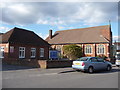
Residents of BH9 2BW have access to a range of amenities within practical reach. The retail sector includes major chains like Co-op Moordown, Tesco Moordown, and Asda Westway, providing everyday shopping convenience. Nearby rail stations—Bournemouth, Branksome, and Pokesdown—connect to the broader South Coast network, while Bournemouth International Airport offers direct flight access. For those preferring water travel, ferry landings at Tuckton Tea Gardens, Christchurch Quay, and Wick Christchurch provide links to nearby towns and attractions. The area’s historical roots are reflected in landmarks like St John’s Church and the art deco Mayfield Park Buildings, adding cultural depth to daily life. The mix of practical amenities and local heritage creates a lifestyle that balances modern needs with a sense of place, ideal for those seeking both accessibility and character.
Amenities
Schools
| Rank | School | Type | Entry gender | Ages |
|---|
Explore more schools in this area
Go to Schools tabDemographics
The community in BH9 2BW is predominantly composed of adults aged 30–64, with a median age of 47. This suggests a mature, stable population, likely with established careers and families. Home ownership is high at 66%, indicating a strong presence of long-term residents rather than transient renters. The area is characterised by houses rather than flats, reflecting a preference for traditional family homes. The predominant ethnic group is White, though no specific data on diversity or deprivation is provided. The age profile and ownership rates imply a neighbourhood focused on comfort and continuity, where residents are likely to prioritise stability over rapid change. The lack of younger demographics or high rental rates suggests a community that values privacy and familiarity over urban dynamism.
Household Size
Accommodation Type
Tenure
Ethnic Group
Religion
Household Composition
Age
Household Deprivation
NS-SEC
Explore more demographic insights in this area
Go to Demographics tabPlanning
Planning Constraints
- Flood RiskPremium
- Ramsar Wetland SitesPremium
- Area of Outstanding Natural BeautyPremium
- Protected Nature ReservePremium
- Protected WoodlandPremium