Area Overview for BH9 2AE
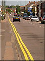
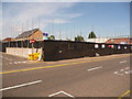
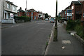
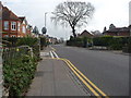
Photos of BH9 2AE


Area Information
BH9 2AE is a small residential postcode area in Bournemouth, Dorset, encompassing parts of Winton and Charminster. With a population of 2,137, it reflects a compact, community-focused setting. The area’s history dates to the late 19th century, when Winton became a civil parish and later merged with Bournemouth. Today, it is a young community, with a median age of 22 and the majority of residents aged 15–29. This demographic suggests a dynamic, possibly student or early-career population. Daily life here is shaped by proximity to retail, transport, and leisure options. Within practical reach are five retail outlets, including Waitrose Winton and Iceland Winton, as well as five railway stations, two airports, and five ferry landings. The area’s blend of convenience and historical roots makes it appealing to those seeking a balance between modern amenities and a sense of local identity.
- Area Type
- Postcode
- Area Size
- Not available
- Population
- 2137
- Population Density
- 8827 people/km²
The property market in BH9 2AE is characterised by a low home ownership rate of 36%, suggesting that rental properties dominate the housing stock. The primary accommodation type is houses, which is atypical for areas with higher rental prevalence, indicating a mix of owner-occupied and rented homes. This dynamic may reflect a balance between long-term residents and those seeking short-term housing solutions. Given the area’s small size, buyers should consider the limited availability of properties and the potential for competition in the rental market. The presence of houses rather than apartments or flats may appeal to those prioritising space or family-oriented living. However, the lower ownership rate could also signal a reliance on local landlords or investment properties, which may affect market stability.
House Prices in BH9 2AE
No properties found in this postcode.
Energy Efficiency in BH9 2AE
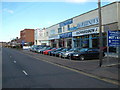
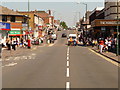
Living in BH9 2AE offers access to a range of amenities within easy reach. Retail options include Waitrose Winton, Lidl Winton, and Iceland Winton, catering to everyday shopping needs. The area’s proximity to five railway stations, two airports, and five ferry landings ensures seamless travel for work, leisure, or exploration. Locally, Winton Recreation Ground and Winton Library provide spaces for recreation and learning. The presence of these facilities fosters a convenient, active lifestyle, with opportunities for both routine errands and weekend excursions. The mix of retail, transport, and green spaces contributes to a balanced daily life, blending practicality with leisure.
Amenities
Schools
| Rank | School | Type | Entry gender | Ages |
|---|
Explore more schools in this area
Go to Schools tabDemographics
The community in BH9 2AE is predominantly young, with a median age of 22 and the most common age range being 15–29 years. This suggests a population skewed toward students, young professionals, or those starting families. Home ownership here is relatively low, at 36%, indicating that a significant portion of residents rent their homes. The primary accommodation type is houses, which is unusual for areas with higher rental markets. The predominant ethnic group is White, though specific data on diversity is not provided. The age profile and ownership figures imply a transient or evolving community, where temporary housing needs may be common. This demographic structure could influence local services and amenities, with a focus on affordability and accessibility for younger residents.
Household Size
Accommodation Type
Tenure
Ethnic Group
Religion
Household Composition
Age
Household Deprivation
NS-SEC
Explore more demographic insights in this area
Go to Demographics tabPlanning
Planning Constraints
- Flood RiskPremium
- Ramsar Wetland SitesPremium
- Area of Outstanding Natural BeautyPremium
- Protected Nature ReservePremium
- Protected WoodlandPremium