Area Overview for BH9 1WB
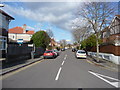
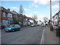
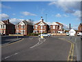
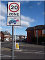
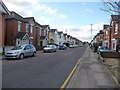
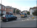
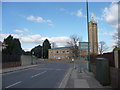
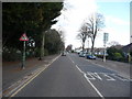
Photos of BH9 1WB
Area Information
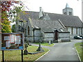
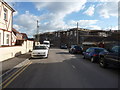
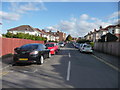
BH9 1WB is a small residential postcode in Bournemouth, England, encompassing a compact cluster of homes with a population of 1,717. Situated north of central Bournemouth, it borders areas such as Winton and Charminster, blending suburban tranquillity with proximity to urban amenities. The area’s history dates back to the Bronze Age, with archaeological finds like 97 cremation urns unearthed in 1873 at Redbreast Hill. Modern development includes the Mayfield Park Estate (circa 1911) and art deco buildings from the 1930s. Residents benefit from a mix of historical landmarks, like St John’s Church, and 20th-century infrastructure, including Wimborne Road. The area’s character is defined by its compact scale, with homes primarily in the 30-64 age range, and a community rooted in local traditions. Its location offers easy access to Bournemouth’s coastal attractions while retaining a distinct identity shaped by its past and present.
- Area Type
- Postcode
- Area Size
- Not available
- Population
- Not available
- Population Density
- Not available
The property market in BH9 1WB is dominated by owner-occupied homes, with 66% of residents owning their properties. This high rate of home ownership indicates a stable, long-term community with fewer rental properties. The area is primarily composed of houses, which are typically larger and suited to families. Given the small size of the postcode and its surrounding areas, the housing stock is limited, making it a niche market for buyers seeking established properties. The absence of specific data on rental availability or property prices means the market’s dynamics are not fully quantified, but the emphasis on owner-occupation suggests a focus on residential permanence rather than transient investment.
House Prices in BH9 1WB
No properties found in this postcode.
Energy Efficiency in BH9 1WB
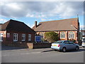
Residents of BH9 1WB have access to a range of amenities within practical reach. Retail options include Co-op Moordown, Tesco Moordown, and Asda Westway, providing everyday shopping convenience. The area is served by five rail stations, including Bournemouth Railway Station and Pokesdown Railway Station, facilitating easy commutes. Nearby airports, such as Bournemouth International Airport, and ferry landings at Tuckton Tea Gardens and Christchurch Quay offer additional transport and leisure opportunities. The presence of historical landmarks like St John’s Church and the Mayfield Park Estate adds character to daily life, while the proximity to Bournemouth’s coastal attractions enhances the area’s appeal. The combination of retail, transport, and cultural assets creates a balanced lifestyle for residents.
Amenities
Schools
| Rank | School | Type | Entry gender | Ages |
|---|
Explore more schools in this area
Go to Schools tabDemographics
The population of BH9 1WB has a median age of 47, with the most common age group being adults aged 30-64. This suggests a mature, stable community with a focus on established households. Home ownership is high at 66%, indicating a predominance of long-term residents rather than transient renters. The area is characterised by houses as the primary accommodation type, reflecting a preference for family homes. The predominant ethnic group is White, aligning with broader trends in the region. The absence of specific data on deprivation means the quality of life cannot be assessed in that context, but the low crime score of 78 (out of 100) and lack of environmental constraints suggest a generally secure and manageable living environment.
Household Size
Accommodation Type
Tenure
Ethnic Group
Religion
Household Composition
Age
Household Deprivation
NS-SEC
Explore more demographic insights in this area
Go to Demographics tabPlanning
Planning Constraints
- Flood RiskPremium
- Ramsar Wetland SitesPremium
- Area of Outstanding Natural BeautyPremium
- Protected Nature ReservePremium
- Protected WoodlandPremium