Area Overview for BH9 1AS
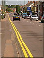
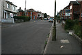
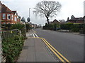
Photos of BH9 1AS


Area Information
BH9 1AS is a small residential postcode in Bournemouth, Dorset, encompassing parts of Winton and Charminster. With a population of around 2,137, it reflects a tight-knit community shaped by its historical ties to Winton, which became a civil parish in 1894. The area’s character is defined by its proximity to key transport hubs and natural amenities. Residents benefit from easy access to Bournemouth Railway Station, Branksome Station, and Pokesdown Station, linking them to regional networks. Nearby, Bournemouth International Airport and ferry services at Tuckton Tea Gardens and Christchurch Quay provide travel flexibility. The ward’s administrative evolution, including its role as an electoral division since 2019, underscores its integration into local governance. Daily life here is influenced by its mix of retail options, from Waitrose to Lidl, and recreational spaces like Winton Recreation Ground. While the area has a youthful demographic, its blend of historical roots and modern connectivity makes it a practical choice for those seeking a balance between convenience and community.
- Area Type
- Postcode
- Area Size
- Not available
- Population
- 2137
- Population Density
- 8827 people/km²
BH9 1AS is a small area with a housing stock predominantly consisting of houses, reflecting its residential cluster nature. With 36% of homes owner-occupied, the market is not heavily skewed toward rentals, though the exact proportion of rental properties is not specified. The relatively low population density and focus on houses suggest a quieter, more suburban environment compared to denser urban areas. For buyers, this means a limited inventory of properties, potentially leading to competition among purchasers. The presence of nearby amenities like retail stores and transport links enhances the area’s appeal, though its small size means buyers must consider surrounding neighborhoods for more options. The mix of houses and the youthful demographic may indicate a market driven by first-time buyers or families seeking space and convenience.
House Prices in BH9 1AS
No properties found in this postcode.
Energy Efficiency in BH9 1AS
Living in BH9 1AS offers a blend of convenience and accessibility. Retail options include Waitrose Winton, Lidl Winton, and Iceland Winton, providing everyday shopping needs. The area’s proximity to Bournemouth Railway Station and other stations makes commuting straightforward, while nearby airports cater to those requiring regular travel. Ferry services at Tuckton Tea Gardens and Christchurch Quay add flexibility for coastal excursions. Recreational spaces like Winton Recreation Ground and Winton Library, established in 1907, offer leisure and cultural activities. The presence of multiple rail, ferry, and air links, combined with local amenities, supports a lifestyle that balances practicality with access to broader regional opportunities. The character of BH9 1AS is defined by its small-scale, community-focused amenities, making it ideal for those prioritizing ease of movement and a connected yet intimate environment.
Amenities
Schools
| Rank | School | Type | Entry gender | Ages |
|---|
Explore more schools in this area
Go to Schools tabDemographics
The population of BH9 1AS has a median age of 22, with the most common age range being 15–29 years. This indicates a young, dynamic community, likely dominated by students, early-career professionals, or families with young children. Home ownership in the area stands at 36%, suggesting a mix of owner-occupied properties and rental stock. The predominant accommodation type is houses, which aligns with the area’s residential character. The ethnic composition is predominantly White, reflecting broader trends in the region. While no specific data on deprivation is provided, the high proportion of young adults and the presence of retail amenities suggest a community that is active and service-oriented. The age profile implies a focus on education and employment opportunities, with proximity to Bournemouth’s universities and transport links playing a key role in shaping local lifestyles.
Household Size
Accommodation Type
Tenure
Ethnic Group
Religion
Household Composition
Age
Household Deprivation
NS-SEC
Explore more demographic insights in this area
Go to Demographics tabPlanning
Planning Constraints
- Flood RiskPremium
- Ramsar Wetland SitesPremium
- Area of Outstanding Natural BeautyPremium
- Protected Nature ReservePremium
- Protected WoodlandPremium