Area Overview for BH8 9PW
Photos of BH8 9PW


Area Information
BH8 9PW is a compact residential postcode in Bournemouth, Dorset, encompassing parts of Muscliff and Strouden Park. The area covers 2.6 hectares and is home to 1,603 residents, making it one of the most densely populated zones in the region, with 61,154 people per square kilometre. Historically, it evolved from heathland and enclosures in the 19th century, shaping its current layout of roads like Muscliff Road and nearby farms that once defined the landscape. Today, it is a quiet suburb with a mix of older and newer housing, positioned near the River Stour valley. Its proximity to Bournemouth’s eastern suburbs offers a balance of suburban tranquillity and access to urban amenities. Residents benefit from nearby rail links, two airports, and a network of ferries, while the area’s compact size means most needs are within walking distance. The community is defined by its stable demographics, with a median age of 47 and a focus on family-oriented living.
- Area Type
- Postcode
- Area Size
- 2.6 hectares
- Population
- 1603
- Population Density
- 1938 people/km²
BH8 9PW is a small, tightly packed area where 59% of homes are owner-occupied, with the remaining 41% likely rented. The accommodation type is predominantly houses, which is unusual for a high-density postcode but suggests a mix of larger, family-friendly properties and smaller homes. This contrasts with typical urban rental markets, where flats or apartments dominate. The limited area size means the housing stock is finite, and buyers should consider proximity to nearby suburbs for broader options. The high home ownership rate indicates a community of settled residents, which may influence property values and desirability. For buyers, the focus on houses implies a need for space, though the compact nature of the area may limit expansion. The market is likely competitive, with demand driven by the area’s proximity to schools, transport, and natural features like Strouden Woods.
House Prices in BH8 9PW
No properties found in this postcode.
Energy Efficiency in BH8 9PW
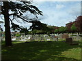
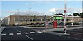
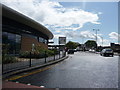
BH8 9PW offers a range of amenities within practical reach, including retail options like Aldi Strouden, Sainsburys Castlepoint, and M&S Castlepoint. The area’s proximity to rail stations, airports, and ferry landings ensures easy access to shopping, travel, and leisure. Nearby parks and natural features, such as Strouden Woods, provide green space for walking or relaxation. The presence of multiple ferry landings, including Wick Christchurch and Tuckton Tea Gardens, allows residents to explore local waterways and coastal areas. The compact nature of the area means amenities are never far, fostering a convenient lifestyle. While the data does not specify dining or entertainment venues, the retail and transport networks suggest a functional, service-oriented environment. The mix of natural and urban amenities supports both active lifestyles and ease of access to broader regional hubs.
Amenities
Schools
Residents of BH8 9PW have access to several primary and secondary schools, including Summerbee Comprehensive School, The Bishop of Winchester Comprehensive School, and Bournemouth School for Girls, which are all primary institutions. The Bishop of Winchester Academy and Bournemouth School for Girls are academies with Ofsted ratings of “good” and “outstanding” respectively. The mix of primary schools and academies provides families with options for both early education and secondary schooling. The presence of an outstanding-rated academy suggests high standards in some institutions, though the data does not specify performance metrics for primary schools. The proximity of multiple schools within practical reach makes BH8 9PW attractive for families prioritising education, with the area’s compact size ensuring schools are never far from home.
| Rank | School | Type | Entry gender | Ages |
|---|
Explore more schools in this area
Go to Schools tabDemographics
The population of BH8 9PW is 1,603, with a median age of 47, indicating a mature demographic skewed toward adults aged 30–64, who make up the most common age range. Home ownership is high at 59%, reflecting a community of long-term residents rather than transient renters. The area is predominantly composed of houses, which aligns with the older age profile and family-focused lifestyle. The predominant ethnic group is White, though no specific data on diversity or deprivation is provided. The high home ownership rate suggests a stable, established community with lower turnover. The absence of detailed diversity statistics means the area’s social fabric remains largely unexplored in the data, but the demographic profile points to a cohesive, middle-aged population with strong ties to local infrastructure and services.
Household Size
Accommodation Type
Tenure
Ethnic Group
Religion
Household Composition
Age
Household Deprivation
NS-SEC
Explore more demographic insights in this area
Go to Demographics tabPlanning
Planning Constraints
- Flood RiskPremium
- Ramsar Wetland SitesPremium
- Area of Outstanding Natural BeautyPremium
- Protected Nature ReservePremium
- Protected WoodlandPremium