Area Overview for BH8 9PT
Photos of BH8 9PT
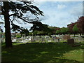
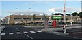
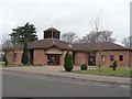
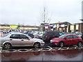


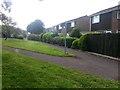
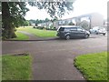
100 photos from this area
Area Information
Key information about the BH8 9PT including its size, population, and administrative classification.
- Area Type
- Postcode
- Area Size
- 1.3 hectares
- Population
- 1603
- Population Density
- 1938 people/km²
House Prices in BH8 9PT
16
Properties
£208,297
Average Sold Price
£32,670
Lowest Price
£360,000
Highest Price
Showing 16 properties
| Address | Type | Beds | Baths | Last Sale Price | Last Sale Date | |
|---|---|---|---|---|---|---|
| 55 East Way, Bournemouth, BH8 9PT | house | - | - | £360,000 | Jan 2022 | |
| 77 East Way, Bournemouth, BH8 9PT | house | - | - | £345,000 | Nov 2021 | |
| 61 East Way, Bournemouth, BH8 9PT | house | - | - | £305,000 | Jul 2018 | |
| 65 East Way, Bournemouth, BH8 9PT | house | 3 | - | £198,000 | Jul 2011 | |
| 59 East Way, Bournemouth, BH8 9PT | Semi-detached | - | - | £197,000 | Jan 2006 | |
| 71 East Way, Bournemouth, BH8 9PT | Semi-detached | - | - | £165,000 | Sep 2005 | |
| 69 East Way, Bournemouth, BH8 9PT | Semi-detached | - | - | £174,000 | Sep 2003 | |
| 75 East Way, Bournemouth, BH8 9PT | house | 3 | 2 | £98,000 | Nov 1999 | |
| 67 East Way, Bournemouth, BH8 9PT | Semi-detached | - | - | £32,670 | Jul 1995 | |
| 79 East Way, Bournemouth, BH8 9PT | Detached | - | - | - | - |
Page 1 of 2
Energy Efficiency in BH8 9PT
Amenities
Schools
| Rank | School | Type | Entry gender | Ages |
|---|
Explore more schools in this area
Go to Schools tabDemographics
Household Size
Family (3-5 people)
most common
Accommodation Type
Houses
most common
Tenure
59
majority
Ethnic Group
White
most common
Religion
N/A
most common
Household Composition
N/A
most common
Age
47
median
Adults (30-64 years)
most common
Household Deprivation
N/A
with no deprivation
NS-SEC
30
in Lower managerial occupations
Explore more demographic insights in this area
Go to Demographics tabPlanning
Planning Constraints
- Flood RiskPremium
- Ramsar Wetland SitesPremium
- Area of Outstanding Natural BeautyPremium
- Protected Nature ReservePremium
- Protected WoodlandPremium