Area Overview for BH8 9NG
Photos of BH8 9NG
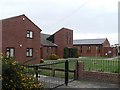
100 photos from this area
Area Information
Key information about the BH8 9NG including its size, population, and administrative classification.
- Area Type
- Postcode
- Area Size
- 1.3 hectares
- Population
- 1654
- Population Density
- 2468 people/km²
House Prices in BH8 9NG
17
Properties
£399,783
Average Sold Price
£249,950
Lowest Price
£685,000
Highest Price
Showing 17 properties
| Address | Type | Beds | Baths | Last Sale Price | Last Sale Date | |
|---|---|---|---|---|---|---|
| 1 Copsewood Avenue, Bournemouth, BH8 9NG | Retail | 3 | 2 | £685,000 | Sep 2022 | |
| 11 Copsewood Avenue, Bournemouth, BH8 9NG | Bungalow | 3 | - | £570,000 | Dec 2020 | |
| 7 Copsewood Avenue, Bournemouth, BH8 9NG | Detached | 2 | 1 | £540,000 | Nov 2017 | |
| 6 Copsewood Avenue, Bournemouth, BH8 9NG | Bungalow | 2 | 2 | £305,000 | Aug 2013 | |
| 17 Copsewood Avenue, Bournemouth, BH8 9NG | Bungalow | 2 | - | £339,950 | Aug 2013 | |
| 10 Copsewood Avenue, Bournemouth, BH8 9NG | Bungalow | - | - | £297,500 | Aug 2010 | |
| 14 Copsewood Avenue, Bournemouth, BH8 9NG | Bungalow | - | - | £290,000 | Jun 2009 | |
| 13 Copsewood Avenue, Bournemouth, BH8 9NG | Bungalow | - | - | £345,000 | Mar 2009 | |
| 4 Copsewood Avenue, Bournemouth, BH8 9NG | Detached | - | - | £249,950 | Jan 2009 | |
| 19 Copsewood Avenue, Bournemouth, BH8 9NG | Detached | - | - | £345,000 | Sep 2007 |
Page 1 of 2
Energy Efficiency in BH8 9NG
Amenities
Schools
| Rank | School | Type | Entry gender | Ages |
|---|
Explore more schools in this area
Go to Schools tabDemographics
Household Size
Family (3-5 people)
most common
Accommodation Type
Houses
most common
Tenure
86
majority
Ethnic Group
White
most common
Religion
N/A
most common
Household Composition
N/A
most common
Age
47
median
Adults (30-64 years)
most common
Household Deprivation
N/A
with no deprivation
NS-SEC
50
in Lower managerial occupations
Explore more demographic insights in this area
Go to Demographics tabPlanning
Planning Constraints
- Flood RiskPremium
- Ramsar Wetland SitesPremium
- Area of Outstanding Natural BeautyPremium
- Protected Nature ReservePremium
- Protected WoodlandPremium