Area Overview for BH8 9DT
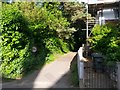
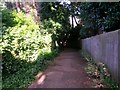
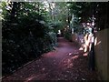
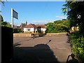
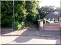
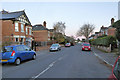
Photos of BH8 9DT


Area Information
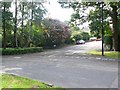
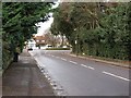
BH8 9DT is a small, residential postcode area in England, home to just 1,889 people. It lies within the broader Bournemouth region, a coastal town in Dorset known for its mix of urban convenience and natural beauty. The area is part of a compact cluster of homes, with a quiet, suburban character shaped by its proximity to Queen’s Park, a large public park that serves as a local hub for recreation. While the coordinates of BH8 9DT fall near Bournemouth’s outskirts, the area benefits from its connection to nearby amenities, including schools, transport links, and retail. Daily life here is defined by a balance of residential calm and access to essential services. The presence of multiple rail stations, such as Bournemouth and Pokesdown, ensures easy commuting for those working in the city or further afield. For those seeking a slower pace, the area’s low crime rate and minimal environmental constraints make it a practical choice for families or individuals looking for a stable, low-risk living environment.
- Area Type
- Postcode
- Area Size
- Not available
- Population
- 1889
- Population Density
- 4703 people/km²
The property market in BH8 9DT is characterised by a high proportion of owner-occupied homes, with 64% of properties owned by residents rather than rented. This suggests a community that values long-term investment in housing, likely attracting buyers seeking stability. The predominant accommodation type is houses, which are typically larger and more private than flats, catering to families or individuals prioritising space. As a small postcode area, the housing stock is limited, meaning buyers may need to consider nearby suburbs for more options. The focus on owner-occupation implies a lower turnover of properties, which can be advantageous for those looking to settle in the area. However, the limited size of BH8 9DT means that property availability may be constrained, requiring buyers to evaluate the broader Bournemouth region for additional choices.
House Prices in BH8 9DT
No properties found in this postcode.
Energy Efficiency in BH8 9DT
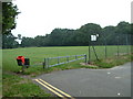
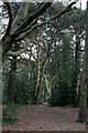
Living in BH8 9DT offers access to a range of amenities that support both everyday needs and leisure. The area is within reach of five retail outlets, including Asda Charminster and Co-op Charminster, ensuring convenient shopping for essentials. For transport, five rail stations, such as Branksome and Pokesdown, provide regular services to Bournemouth and beyond, while two airports cater to regional and international travel. The nearby ferry landings, including Wick Christchurch, connect residents to local waterways and coastal attractions. Recreational opportunities are enhanced by proximity to Queen’s Park, a large public space featuring a golf course, which offers space for outdoor activities. The combination of retail, transport, and green spaces creates a lifestyle that balances convenience with access to natural and urban amenities.
Amenities
Schools
The nearest school to BH8 9DT is Dewlish House School, an independent institution. Independent schools are typically fee-paying and often offer smaller class sizes and specialist facilities, though no Ofsted rating is provided in the data. The presence of a single school in the area suggests a limited choice for families, but Dewlish House’s status as an independent school may appeal to those seeking alternative education models. For parents prioritising state education, the data does not include other schools, meaning further research would be necessary to identify nearby state-run options. The absence of multiple schools highlights a potential gap in the area’s educational infrastructure, though the existing institution provides a clear pathway for families seeking independent schooling.
| Rank | School | Type | Entry gender | Ages |
|---|
Explore more schools in this area
Go to Schools tabDemographics
The population of BH8 9DT is predominantly composed of adults aged 30–64, with a median age of 47. This suggests a mature, established community, likely with strong ties to local institutions and a focus on stability. Home ownership in the area stands at 64%, indicating a mix of owner-occupied properties and rental units. The accommodation type is primarily houses, reflecting a suburban layout rather than high-density living. The predominant ethnic group is White, which aligns with broader demographic trends in the region. While no data on deprivation is provided, the high home ownership rate and low crime risk suggest a generally stable socioeconomic profile. The absence of significant diversity metrics in the data means the community’s cultural makeup remains less defined, but the area’s small size and focus on houses imply a cohesive, possibly family-oriented population.
Household Size
Accommodation Type
Tenure
Ethnic Group
Religion
Household Composition
Age
Household Deprivation
NS-SEC
Explore more demographic insights in this area
Go to Demographics tabPlanning
Planning Constraints
- Flood RiskPremium
- Ramsar Wetland SitesPremium
- Area of Outstanding Natural BeautyPremium
- Protected Nature ReservePremium
- Protected WoodlandPremium