Area Overview for BH8 9AY
Photos of BH8 9AY
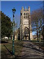
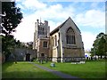


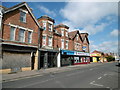
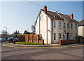
100 photos from this area
Area Information
Key information about the BH8 9AY including its size, population, and administrative classification.
- Area Type
- Postcode
- Area Size
- 1.6 hectares
- Population
- 1691
- Population Density
- 1822 people/km²
House Prices in BH8 9AY
24
Properties
£325,765
Average Sold Price
£132,000
Lowest Price
£560,000
Highest Price
Showing 24 properties
| Address | Type | Beds | Baths | Last Sale Price | Last Sale Date | |
|---|---|---|---|---|---|---|
| 22 Egerton Road, Bournemouth, BH8 9AY | house | - | - | £560,000 | Aug 2021 | |
| 20 Egerton Road, Bournemouth, BH8 9AY | house | - | - | £315,000 | Oct 2018 | |
| 30 Egerton Road, Bournemouth, BH8 9AY | house | - | - | £478,720 | Nov 2013 | |
| 18 Egerton Road, Bournemouth, BH8 9AY | house | - | - | £330,000 | May 2013 | |
| 25 Egerton Road, Bournemouth, BH8 9AY | house | - | - | £366,000 | Oct 2012 | |
| 37 Egerton Road, Bournemouth, BH8 9AY | house | 5 | - | £440,000 | Aug 2012 | |
| 31 Egerton Road, Bournemouth, BH8 9AY | house | - | - | £447,500 | Aug 2010 | |
| 23 Egerton Road, Bournemouth, BH8 9AY | house | - | - | £439,950 | Nov 2007 | |
| 32 Egerton Road, Bournemouth, BH8 9AY | Semi-detached | - | - | £494,000 | Sep 2006 | |
| 17 Egerton Road, Bournemouth, BH8 9AY | Detached | 5 | 2 | £325,000 | Dec 2005 |
Page 1 of 3
Energy Efficiency in BH8 9AY
Amenities
Schools
| Rank | School | Type | Entry gender | Ages |
|---|
Explore more schools in this area
Go to Schools tabDemographics
Household Size
Family (3-5 people)
most common
Accommodation Type
Houses
most common
Tenure
61
majority
Ethnic Group
White
most common
Religion
N/A
most common
Household Composition
N/A
most common
Age
47
median
Adults (30-64 years)
most common
Household Deprivation
N/A
with no deprivation
NS-SEC
38
in Lower managerial occupations
Explore more demographic insights in this area
Go to Demographics tabPlanning
Planning Constraints
- Flood RiskPremium
- Ramsar Wetland SitesPremium
- Area of Outstanding Natural BeautyPremium
- Protected Nature ReservePremium
- Protected WoodlandPremium