Area Overview for BH8 8UG
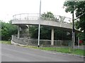
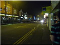
Photos of BH8 8UG


Area Information
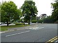
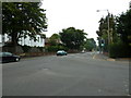
Postcode BH8 8UG sits within a specific residential cluster that forms part of the broader Talbot and Branksome Woods ward. This area in Dorset encompasses the suburbs of Talbot Woods, Branksome Woods, and Meyrick Park, alongside parts of Talbot Village and Charminster. The townsend community today supports a population of 1902 residents. You are looking at a specific postcode area covering a small residential cluster defined by its suburban character and wooded surroundings. The location sits on the boundary between Bournemouth and Poole, placing the BH8 8UG cluster near the coordinates for the historic centres. Residents benefit from proximity to the Talbot Campus of Bournemouth University, which lies within the wider ward. The land historically served as a model village developed between 1850 and 1862 by sisters Georgina and Mary Anne Talbot. These sisters provided employment, housing, and almshouses to impoverished locals following the Inclosure Acts. Today, the area retains its leafy, green identity with a strong sense of community. Living in BH8 8UG means enjoying a quiet, leafy suburb that blends historic cottages with modern housing developments. The surroundings feature historic elements like the Talbot Village Conservation Area, ensuring the practical character of the estate remains intact for future residents.
- Area Type
- Postcode
- Area Size
- Not available
- Population
- Not available
- Population Density
- Not available
The property market in BH8 8UG is characterised by a mix of tenures and accommodation types. Current data indicates that 45% of households in this postcode own their homes. This means nearly half of the residents have purchased property locally or inherited it. Conversely, the other half resides in the private rental sector. Flats are the predominant form of accommodation, which distinguishes this area from neighbours with more large family houses. This mix creates a diverse market where you might find both apartments and traditional suburban homes within immediate proximity. The location within the Talbot and Branksome Woods ward adds value to properties in BH8 8UG. The presence of the Talbot Campus of Bournemouth University in the wider ward influences local demand. Buyers looking for flats will find abundant stock in this specific cluster. However, owners in this area benefit from a higher degree of stability than in purely rental zones. The 45% ownership figure suggests a balanced market where buying is a realistic option for many households. You should expect a range of properties suitable for singles, couples, and empty nesters given the preponderance of flats. The specific nature of the housing stock means you must check building types carefully before viewing. This area offers a practical option for those seeking flats in a historically significant Dorset location. The blend of owned and rented properties ensures a steady turnover of housing stock.
House Prices in BH8 8UG
No properties found in this postcode.
Energy Efficiency in BH8 8UG
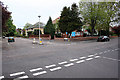
Residents of BH8 8UG enjoy convenient access to a variety of retail and leisure amenities. There are five retail venues within practical reach, including Tesco Bournemouth, Co-op Charminster, and Asda Charminster. These supermarkets and shops are located near Charminster and Bournemouth, ensuring daily shopping needs are met easily. Transport connectivity is supported by five nearby railway stations, including Bournemouth Railway Station and Branksome Railway Station, and two airports serve the region. There are also five ferry landing sites accessible, such as Wick Christchurch Ferry Landing and Tuckton Tea Gardens Ferry Landing. These links to the coast add a leisure dimension to your lifestyle options. The area is situated on the Bournemouth-Poole boundary, providing easy access to beaches and gardens. The character of the location is defined by its leafy, green nature and proximity to Albion Woods plantation. Highmoor Farm remains operational in the wider ward, offering local agricultural interest. You can walk the historic footpaths of Talbot Village Conservation Area, designated in 1975. This area protects listed cottages and St Mark's Church, enriching your daily environment with heritage. The presence of the Talbot Campus of Bournemouth University within the ward adds a cultural and academic backdrop to the suburb. Living in BH8 8UG offers a balance of modern shopping convenience and historic woodland settings. The variety of transport links ensures you can travel quickly to Bournemouth, Poole, or the coast. Your lifestyle will blend the quietude of a historic village with the practicalities of a modern commuter town.
Amenities
Schools
Families selecting BH8 8UG have access to specific educational institutions nearby. The nearest school to this postcode is St Martin's School. This institution operates as an independent school. Recent monitoring by the education authority has rated St Martin's School as 'good' according to Ofsted standards. As an independent provider, it caters to families seeking a specific curriculum or educational philosophy outside the state sector. This option represents the only school currently listed for the BH8 8UG cluster. The mix of school types here is narrow but specific. There are no state-maintained primary or secondary schools explicitly named in the immediate data for this postcode. This concentrates choice for parents around this single independent provider. For children entering the state system, families would likely look to schools in the wider Talbot and Branksome Woods ward. St Mark's Church of England Primary is noted within the broader ward history, extending to 460 pupils by 1992, though it is not detailed in the immediate BH8 8UG school list. The presence of St Martin's School suggests a demand for private education in the local vicinity. Access to this 'good' rated independent school is a tangible benefit for households residing in this specific postcode. Parents should verify current catchment areas for state schools in the wider borough to complement their child's education plan. The clarity of the school offering simplifies the decision-making process for families settling in this cluster.
| Rank | School | Type | Entry gender | Ages |
|---|
Explore more schools in this area
Go to Schools tabDemographics
The community within BH8 8UG reflects a settled demographic with a specific household composition. Residents here skew towards adulthood, with the majority falling into the 30 to 64 years age range. The median age for people in this postcode is 47 years. This profile suggests a stable population rather than a transient student or young professional hub. In terms of housing tenure, 45% of residents in BH8 8UG own their homes outright or with a mortgage. The remaining households are within the private rental sector. You will find that flats are the predominant form of accommodation in this specific cluster. The most common ethnic group in the area is White. The demographic data does not indicate a high concentration of students, which aligns with the median age figure. This age structure points to families and mature individuals seeking stability. Unlike university town centres, this area lacks a massive influx of younger undergraduates. Instead, the housing stock caters to those established enough to seek long-term residence. The 45% ownership rate indicates significant investment in the area, making it attractive for buyers looking for security. The age distribution and ownership patterns suggest a neighbourhood where people plan to stay. Understanding these figures helps you gauge whether the community aligns with your own life stage and housing needs.
Household Size
Accommodation Type
Tenure
Ethnic Group
Religion
Household Composition
Age
Household Deprivation
NS-SEC
Explore more demographic insights in this area
Go to Demographics tabPlanning
Planning Constraints
- Flood RiskPremium
- Ramsar Wetland SitesPremium
- Area of Outstanding Natural BeautyPremium
- Protected Nature ReservePremium
- Protected WoodlandPremium