Area Overview for BH8 8PJ
Photos of BH8 8PJ
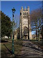


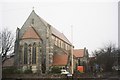

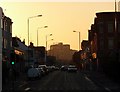
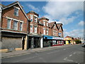
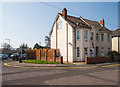
100 photos from this area
Area Information
Key information about the BH8 8PJ including its size, population, and administrative classification.
- Area Type
- Postcode
- Area Size
- 5964 m²
- Population
- 2126
- Population Density
- 10494 people/km²
House Prices in BH8 8PJ
39
Properties
£267,704
Average Sold Price
£66,500
Lowest Price
£372,500
Highest Price
Showing 39 properties
| Address | Type | Beds | Baths | Last Sale Price | Last Sale Date | |
|---|---|---|---|---|---|---|
| 74 Malmesbury Park Road, Bournemouth, BH8 8PJ | house | - | - | £370,000 | Nov 2025 | |
| 138 Malmesbury Park Road, Bournemouth, BH8 8PJ | Semi-detached | 3 | - | £246,000 | Jul 2024 | |
| 82 Malmesbury Park Road, Bournemouth, BH8 8PJ | Terraced | 3 | 2 | £335,000 | Apr 2024 | |
| 78 Malmesbury Park Road, Bournemouth, BH8 8PJ | Terraced | 4 | 3 | £372,500 | Sep 2021 | |
| 68 Malmesbury Park Road, Bournemouth, BH8 8PJ | house | - | - | £289,950 | Apr 2021 | |
| 80 Malmesbury Park Road, Bournemouth, BH8 8PJ | house | 5 | 4 | £330,000 | Feb 2019 | |
| 66 Malmesbury Park Road, Bournemouth, BH8 8PJ | house | - | - | £226,000 | Jan 2019 | |
| 72 Malmesbury Park Road, Bournemouth, BH8 8PJ | house | - | - | £318,000 | Mar 2017 | |
| 134 Malmesbury Park Road, Bournemouth, BH8 8PJ | Flat | - | - | £158,500 | Sep 2012 | |
| 70 Malmesbury Park Road, Bournemouth, BH8 8PJ | house | - | - | £250,000 | Dec 2008 |
Page 1 of 4
Energy Efficiency in BH8 8PJ
Amenities
Schools
| Rank | School | Type | Entry gender | Ages |
|---|
Explore more schools in this area
Go to Schools tabDemographics
Household Size
Family (3-5 people)
most common
Accommodation Type
Houses
most common
Tenure
47
majority
Ethnic Group
White
most common
Religion
N/A
most common
Household Composition
N/A
most common
Age
47
median
Adults (30-64 years)
most common
Household Deprivation
N/A
with no deprivation
NS-SEC
29
in Lower managerial occupations
Explore more demographic insights in this area
Go to Demographics tabPlanning
Planning Constraints
- Flood RiskPremium
- Ramsar Wetland SitesPremium
- Area of Outstanding Natural BeautyPremium
- Protected Nature ReservePremium
- Protected WoodlandPremium