Area Overview for BH8 8JB
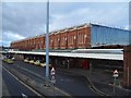
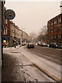
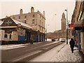
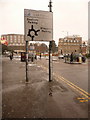
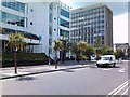
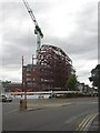
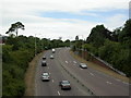
Photos of BH8 8JB

Area Information
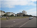
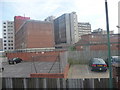
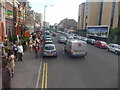
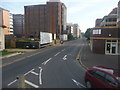
BH8 8JB is a small residential postcode area in Bournemouth, England, encompassing parts of the Bournemouth Central electoral ward. With a population of 2782, it lies at the heart of Bournemouth’s urban core, near the coast between West Cliff and East Cliff. The area is defined by its compact size and proximity to key landmarks such as the Royal Exeter Hotel, Bournemouth Town Hall, and the Pavilion Theatre. Historically, the ward was formed in 2019, merging parts of the former Central ward. Daily life here is shaped by its role as Bournemouth’s central business district, offering a mix of retail, cultural, and administrative hubs. The area’s diversity is notable, with residents employed across sectors like wholesale/retail, hospitality, and finance. While the postcode includes a cluster of flats, its urban character contrasts with the surrounding coastal landscapes. For buyers, BH8 8JB represents a blend of convenience and accessibility, though its small size means the housing stock is limited to a specific cluster of properties.
- Area Type
- Postcode
- Area Size
- Not available
- Population
- 2782
- Population Density
- 14008 people/km²
The property market in BH8 8JB is characterised by a low home ownership rate of 29%, suggesting that the area is largely a rental market rather than a hub for owner-occupied homes. The predominant accommodation type is flats, which aligns with the urban, high-density nature of the postcode. This limited housing stock means that buyers have few options within BH8 8JB itself, with much of the demand likely shifting to adjacent areas. The small size of the postcode further restricts the availability of properties, making it a niche market for those prioritising proximity to Bournemouth’s central amenities. For buyers, this could mean competing with renters and investors in a tightly contested market. The flat-dominated landscape may also appeal to those seeking affordable, manageable housing in a convenient location, though property value appreciation may be constrained by the area’s limited expansion potential.
House Prices in BH8 8JB
No properties found in this postcode.
Energy Efficiency in BH8 8JB
Living in BH8 8JB offers access to a range of amenities within practical reach. Retail options include major chains such as Asda Bournemouth and Tesco Bournemouth, providing convenience for daily shopping. The area’s rail network, with stations like Bournemouth and Pokesdown, connects residents to broader regional transport links, while ferry landings at Tuckton Tea Gardens and Christchurch Quay offer scenic and functional travel options. Nearby airports, including Bournemouth International Airport, cater to those requiring frequent air travel. The urban setting also places residents near cultural and historical landmarks, such as the Royal Exeter Hotel and Bournemouth Town Hall. This mix of retail, transport, and leisure facilities supports a dynamic lifestyle, though the small postcode size means that some amenities may require a short journey to access. The area’s proximity to the coast and central Bournemouth adds to its appeal for those seeking a balance between urban convenience and coastal accessibility.
Amenities
Schools
The nearest school to BH8 8JB is Wyvern House Tutorial College, an independent institution. While no Ofsted rating is provided, independent schools typically offer selective admission and often have higher tuition fees compared to state-run institutions. This school caters to families seeking private education, though the absence of other schools in the immediate vicinity means that families may need to consider commuting to other parts of Bournemouth for additional educational options. The lack of state schools in the area could be a consideration for those prioritising affordability or proximity to a broader range of educational facilities. For parents, the presence of an independent school reflects the area’s appeal to households seeking private schooling, though it also underscores the need for careful planning regarding school catchment areas and travel logistics.
| Rank | School | Type | Entry gender | Ages |
|---|
Explore more schools in this area
Go to Schools tabDemographics
The population of BH8 8JB is predominantly young adults, with a median age of 22 and the most common age range being 15–29 years. This suggests a community skewed toward students, early-career professionals, and those in rental accommodation. Home ownership here is relatively low at 29%, indicating that the area is more rental-focused than owner-occupied. The accommodation type is primarily flats, reflecting the urban density of the postcode. The predominant ethnic group is White, though the ward is noted as the most diverse in Bournemouth, though specific diversity statistics are not quantified in the data. The young demographic profile may influence local amenities and services, with a focus on transient or short-term housing needs. The low home ownership rate could also impact long-term investment potential for buyers seeking stable property value growth.
Household Size
Accommodation Type
Tenure
Ethnic Group
Religion
Household Composition
Age
Household Deprivation
NS-SEC
Explore more demographic insights in this area
Go to Demographics tabPlanning
Planning Constraints
- Flood RiskPremium
- Ramsar Wetland SitesPremium
- Area of Outstanding Natural BeautyPremium
- Protected Nature ReservePremium
- Protected WoodlandPremium