Area Overview for BH8 8EA
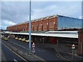
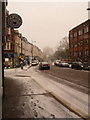
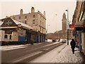
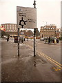
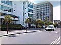
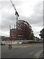
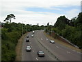
Photos of BH8 8EA

Area Information
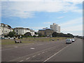
BH8 8EA is a small residential cluster nestled in Bournemouth’s central business district, part of the Bournemouth Central electoral ward. With a population of 2,007, it forms a compact urban area near the coast, bounded by West Cliff and East Cliff. The area’s character is shaped by its history as a commercial and administrative hub, with landmarks like the Royal Exeter Hotel (1812) and Bournemouth Town Hall (1885) anchoring its identity. Daily life here is defined by proximity to retail, transport, and cultural amenities, though the ward’s diversity—its most ethnically varied in Bournemouth—adds to its dynamic atmosphere. Young professionals and students are prominent, drawn by employment opportunities in retail, hospitality, and finance. The area’s compact size means residents can walk to key services, though its urban density contrasts with the broader coastal landscapes of Bournemouth. Its location near Bournemouth International Airport and rail networks makes it a convenient base for commuters, though the 1908 tramway accident that killed seven people remains a historical footnote in its otherwise modern, fast-paced environment.
- Area Type
- Postcode
- Area Size
- Not available
- Population
- Not available
- Population Density
- Not available
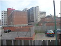
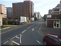
The property market in BH8 8EA is characterised by a low home ownership rate of 34%, with flats making up the majority of accommodation. This suggests a rental-dominated market, typical of urban areas with limited housing diversity. The small size of the postcode area means housing options are constrained, with most properties concentrated in the central business district. Flats in this area are likely to be smaller, suited to young professionals or students, though the lack of specific data on property prices or types means buyers must look beyond BH8 8EA for broader options. The rental market may offer affordability for those seeking short-term stays or proximity to amenities, but the limited housing stock could make competition fierce. For buyers, this area is better viewed as a stepping stone or investment in a high-traffic location rather than a long-term residential choice.
House Prices in BH8 8EA
No properties found in this postcode.
Energy Efficiency in BH8 8EA
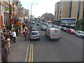
Living in BH8 8EA offers access to a range of amenities within practical reach. Retail options include Tesco Bournemouth, The Southern Co-operative Co, and Asda Bournemouth, providing daily essentials. The area’s urban core is complemented by nearby leisure spots like Tuckton Tea Gardens Ferry Landing and Christchurch Quay, which blend historical charm with recreational opportunities. Rail stations such as Branksome and Pokesdown connect residents to broader networks, while Bournemouth International Airport ensures easy travel. The presence of multiple churches, cultural landmarks, and educational institutions like Bournemouth and Poole College reflects the area’s mix of heritage and modernity. This blend of retail, transport, and cultural assets creates a convenient, fast-paced lifestyle, though the compact size means residents must venture slightly beyond the postcode for more expansive green spaces or quieter environments.
Amenities
Schools
| Rank | School | Type | Entry gender | Ages |
|---|
Explore more schools in this area
Go to Schools tabDemographics
The population of BH8 8EA is predominantly young, with a median age of 22 and the most common age range being 15–29 years. This reflects a community skewed toward students, graduates, and early-career professionals. Home ownership is relatively low at 34%, indicating that the area is more rental-focused than owner-occupied. The accommodation type is predominantly flats, which aligns with the urban, high-density nature of the ward. The predominant ethnic group is White, though the ward is noted as the most diverse in Bournemouth, suggesting a mix of backgrounds. The age profile and housing stock imply a transient population, with limited long-term residency. This demographic structure influences local services, which cater to younger, mobile residents. The lack of specific deprivation data means quality of life is not explicitly quantified, but the mix of employment sectors—wholesale/retail, hospitality, and finance—suggests opportunities for those seeking flexible or service-based work.
Household Size
Accommodation Type
Tenure
Ethnic Group
Religion
Household Composition
Age
Household Deprivation
NS-SEC
Explore more demographic insights in this area
Go to Demographics tabPlanning
Planning Constraints
- Flood RiskPremium
- Ramsar Wetland SitesPremium
- Area of Outstanding Natural BeautyPremium
- Protected Nature ReservePremium
- Protected WoodlandPremium